Posted on 3 Comments

Bushwalking Bans Looming in the Grampians/Gariwerd

Tourist hordes are swarming over ancient quarried edges beside a popular Parks Victoria walking track in the Grampians/Gariwerd.  Some are sitting beside quarried edges that are surrounded by graffiti. They are seemingly oblivious to the cultural heritage significance of the site.  Elsewhere in the National Park, graffiti (including false rock-art) spoils a rock shelter and threatens genuine indigenous rock art. Amazingly, this site is a Parks Victoria (PV) authorised campsite that is popular with walkers doing a multi-day hike. The Oasis campsite on the Fortress walking trail has tragically been trashed.

Graffiti on rock walls which run right up against the Grampians Peak Trail

Massive graffiti damage on a wall along the Grampians Peak Trail

At yet another tourist site in the Park, rock art is protected by a steel cage but tourists can easily scramble above and behind the cage location to find other less obvious but nonetheless easily discernible rock art and quarry sites that are marred by scratched and painted graffiti. The aforementioned tourist sites, and a number of others where damage to cultural heritage has occurred and continues to occur, remain open to all and sundry.  This is despite Parks Victoria having been alerted to the existence of cultural heritage at these sites and photographic evidence having been supplied.

New graffiti next to a quarry site at the Manja Shelter in the Victoria Range

Meanwhile, rockclimbers have found themselves excluded from vast tracts of the Grampians/Gariwerd and a growing number of key sites in nearby world climbing mecca, Mt Arapiles/Dyurrite.  Parks Victoria has consistently justified these exclusions on the basis of their “legislative obligations to protect cultural heritage”. Climbers have been perplexed by their exclusions from sites that have not been assessed for cultural heritage because of what PV management have called a “precautionary approach” (i.e. “we will keep you out just in case we might find something of significance there one day”). They are even more perplexed by their continuing exclusions from sites that have been assessed and where no tangible cultural heritage has been found. And they have been galled by what they see as double standards and the discriminatory application of regulations to some groups of recreational users of the Park but not to others.

Given that such blatant anomalies and discrepancies in the protection of cultural heritage sites have been pointed out to PV officials, and that Traditional Owners have stated that “protection of cultural heritage is non-negotiable”, it is understandable why some PV officials have privately admitted that it is inevitable that access to numerous tourist sites will soon be prohibited and multiple popular walking trails will be closed.

Graffiti damage inside Hollow Mountain

Along waterways and beside lakes in the Grampians that are popular with both walkers and fisher-folk, there are a number of cultural heritage sites that are listed in the Aboriginal Heritage Register.  It feels inevitable that access restrictions or prohibitions will soon be applied at these sites too. PV have no options since they are required to meet their legislative obligations. These actions of course spell disaster for many of us. Bans on walking trails and climbing areas may take years to resolve and in many cases these sites may never open again. Bushwalkers might hope for a far more granular approach to protection of cultural heritage than is embodied in Set-aside Determination. Unfortunately climbers have suddenly found themselves faced with bans which currently prohibits climbing in over 550 square kilometres of the Grampians/Gariwerd.  Bushwalkers should look no further than recent history and politics, which suggests that hope alone will not be enough. Check out this Save Grampians Climbing post HERE for further details

Quarry site and graffiti as you enter Hollow Mountain
Posted on 1 Comment

Healthy Parks – Wealthy People

hpwp


For many years the various organisations that have run Victorian Parks have had an objective of increasing visitor numbers. The most recent incarnation, Parks Victoria, has gained a new objective – a greater proportion of Parks expenditure is to be raised from users and less is to be provided through government budgets. Are the two objectives compatible? The recently released Regulatory Impact Statement (RIS) and its proposed increases in camping fees assumes the two objectives are compatible. I believe the RIS uses weak research and an avoidance of challenging questions to maintain this pretence. Here is why.

Horizontal equity – merely an excuse for regressive cost shifting:

The fundamental objective of the RIS is cost recovery for camping in parks. This objective is partially justified by the principle of horizontal equity. Stripped to its basics as used in the RIS, this is the principle that all users should pay the full costs of the camping services they use in Victorian Parks. No one group of campers should subsidise another. There are two problems with this simplistic principle.

  • Why should horizontal equity only be applied to campers. Why should it not be applied to day visitors or to those who derive benefit merely from knowing that Parks exist and are accessible? The answer is that campers are more easily regulated.
  • More importantly, the proposed fee structure will apply the same nominal costs to campers irrespective of income and so will discriminate against lower income campers who will be required to pay a greater proportion of their disposable income to camp. Its impact will be felt most strongly by those who choose camping as an affordable form of recreation. This is hardly horizontal equity. It is a form of regressive taxation. This regressivity will change camping behaviour in ways not anticipated in the RIS.

Most camping visitation is to low cost options – suggesting price influences camping choices

Three quarters of camping visits are to basic and very basic camp sites. Currently these sites have modest fees. The high useage suggests price is likely a factor in the choices of many of campers. This issue is dismissed by the RIS using short citations from a study by Deakin University. Too little detail is provided to determine if sample used in the study is representative of the high number of users of low-cost sites. But if the sample is representative, half of the respondents suggested they would choose another option if camping prices rose. This limited evidence of camping ‘price elasticity’ is dismissed in the RIS with no explanation. This is a fatal flaw in the RIS logic.

Price elasticity of camping demand – higher prices will divert campers

The charging of a $13 fee for a basic camp option may have little impact on the use of these facilities. However, most car-based camping sites that have till now been used as low-cost camping options are being re-classified as mid or high cost camping sites. The case of the Grampians is instructive. All eleven car-based camping sites in the Grampians have been classified as mid or high level service. Currently the majority are low cost options. After the new fees are applied, no low-cost options will remain. The daily fee per vehicle in any of these sites will be between $34 and $50 – a rise of between 170% and 300%. This is a very hefty rise. Despite the scale of proposed fee increases, the RIS makes no real attempt to assess the impact on visitation, other than to cite a poorly designed question in the Deakin survey which asked respondents if they were willing to pay a ‘reasonable’ fee. The concept of ‘reasonable’ is in the eye of the beholder. I imagine few respondents would have considered a 300 per cent rise to be reasonable. It appears the survey gave no indication of the potential scale of fee rises. This makes the survey useless as anything other than a tool for opportunistic citation. And this is how the RIS has used it. To paraphrase its argument- campers agree they would pay a reasonable charge. We define a 300 per cent increase is reasonable. Therefore campers will accept this fee increase. This is hardly credible analysis.

The survey should now be repeated and users asked whether the proposed fee increases are reasonable and whether they would be willing to pay them. We all know that the response to these questions would be very different to the repsonse in the Deakin survey. The outcome of the proposed fee increase can be predicted with reasonable confidence:

  • Fewer camping visit: A significant proportion of low income (and possibly other) campers will reduce their visitation to formal campsites. Some may convert to day visitation. Some may not visit.
  • Diversion to commercial facilities: Some current users will make an assessment that the price charged for basic Parks Vic camp sites is significantly more expensive than commercial campsites that offer services unavailable in Parks sites – hot showers, washing machines and camp kitchens etc. They will divert to commercial options. [This raises a suspicion that the fee rise is partly designed to increase the profits of private operators – particularly any future operators buying the new 99 year leases of park land]
  • Informal and illegal camping will increase. The RIS acknowledges that non-compliance with fees is already high (60 per cent). The fee rises proposed will provide a vastly increased incentive for non-compliance. Parks will need to either increase surveillance of informal camping areas, or accept lower revenue and the potential threat to park values.

Is the future will remote campsites be closed due to negative returns?

If maintaining park visitation was considered a real objective of Parks Victoria, much greater consideration would have been given to the price elasticity and cross-elasticity’s of camping. There would have been a serious attempt to estimate the level of fee increase that could be achieved without reducing visitation. The absence of such a consideration from the RIS suggests that revenue raising is now the over-riding objective of Parks Victoria. If the proposed fee increases do reduce visitation, divert campers to commercial facilities and increase informal camping, the revenue estimates in the RIS will be proved grossly optimistic. Little additional revenue will be raised, but visitation will have shrunk.

At the same time, increased illegal camping and non-compliance will require the diversion of Parks Victoria staff, if not to enforce revenue targets, at least to protect park values where these might be threatened by informal camping. This will either increase Parks Victoria’s costs, or more likely decrease the investment of Parks Victoria budget in the rest of the work needed to protect our Parks.

If these predictions become reality, Parks Victoria will face the realisation that many lower level service and remote camp sites will never be self-funding. Given the current climate, the next logical step would be to close these campsites as unviable. This future seems quite at odds with an objective of increasing park visitation. Park visitation will become a recreation only for the wealthy able to afford to stay in the higher level facilities (more than $200 a night) or in whatever up-market facilities are created on the 99 year leases. These will not provide low cost camping. Parks Victoria could then change the logo on its vehicles from “Healthy Parks – Healthy People” to “Healthy Parks – Wealthy People”. This would only require repainting one letter and should be affordable within the currently stretched Parks Victoria budget. At least then we would all know where we stood. Parks exist to serve those able to pay hefty visitor fees. The alternative is a fundamental rethink of Parks Victoria priorities and an investment in credible research.

[Open Spaces: This piece was provided by one of our regular readers and who wishes to remain anonymous. It follows on from Glenn Tempest’s short blog/response to the Victorian National Parks Camping and Accommodation Fees Regulatory Impact Statement (Healthy Parks, Wealthy People) from last week. ]


Posted on Leave a comment

Falcons Lookout Trail Improvements

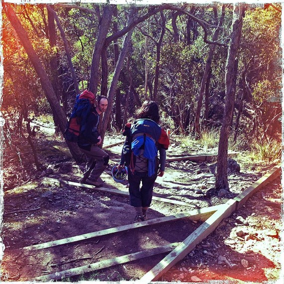
Last December Glenn Tempest wrote a blog (Problems with Falcons Lookout and Ironbark Gorge Carpark) commenting on the awful state of the walkers/climbers trail into Falcons Lookout at Werribee Gorge State Park. This trail is one of the most heavily used in Victoria and can see anything up to 60 people use it a day. Since then Parks Victoria have gone some way to fixing the issue. The works were not quite finished when we were there on Sunday but there is already a welcome improvement. However, despite these works, using pine boards in this manner is only really a temporary measure. In a couple of years time the boards will have almost certainly collapsed and we will again be faced with the same issues of erosion and user safety. Glenn pointed out in his original blog that “it may be simpler, cheaper and quicker to realign this section of the trail down the spur 20m or so to the west, then cut it back to the point at where the original trail reaches the bottom of the gully.”. In the long term this is probably true, but Parks Victoria is cash-strapped (see Glenn Tempest’s Parks Victoria: Death by a Thousand Cuts) and probably can’t afford the cost of these works. Looks like we will have to put up with band-aid measures for a long time to come.

Update May 2013
Looks like Parks Victoria have recently added more timber to the steps. Once again an improvement.

CameraZOOM-20130519164237672

Posted on 3 Comments

Rockclimbs Around Melbourne iPhone App

Open Spaces and iCrag are excited to announce that the popular climbing guidebook, Rockclimbs Around Melbourne by Glenn Tempest, is now available as the iCrag – Melbourne app through the Apple App Store here.

This app covers a selection of the best climbs on eight of the most popular crags within one and a half hours drive of the Melbourne CBD. The climbing varies between single-pitch granite sport climbs to long multi-pitch trad sandstone routes.


Climbing areas include:

  • The You Yangs
  • Falcons Lookout (Werribee Gorge)
  • Mt Beckworth
  • Camels Hump
  • Black Hill
  • Mt Alexander
  • Ben Cairn
  • Cathedral Range

App features include:

  • Over 500 selected routes
  • Over 75 cliff images
  • Text descriptions
  • First ascent details
  • Advanced search facilities
  • Zoom functions
  • Navigate by list
  • Navigate by images
  • Climb grade index
  • Climb name index


Users of the iCrag – Melbourne app will find that all of our current corrections and updates have been incorporated. The app uses the same iCrag engine as used in the popular and acclaimed iCrag – Arapiles app.

iCrag – Melbourne sells for $14.99. Those purchasing the app will be entitled to a 25% discount (rom Open Spaces) on the print version of Rockclimbs Around Melbourne. You can find the details about this great deal by clicking on the About OSP button on the home screen of the app.

Compatible with iPhone, iPod touch, and iPad. Requires iOS 4.0 or later. File size is 99.2MB.

Visit iCrag (to see a video of the iCrag app engine in operation) or the Apple App Store.


Like us on Facebook
and Win a Copy of iCrag – Melbourne

We also have one copy of iCrag – Melbourne to give away. Just go to our Open Spaces facebook site and like us and you’ll go in to the draw. The contest ends at midday (Melbourne time) on 10 May 2012. We’ll notify the winner via facebook on the same day. Good Luck.

Posted on Leave a comment

Tarilta Creek Gorge Burn. The Unanswered Questions.

A couple of weeks ago Glenn Tempest wrote a blog about the March 2012 DSE burn in Tarilta Creek Gorge. Friends of the Box-Ironbarks Forests (FOBIF) also posted a critical assessment of the DSE burning operations in the Upper Loddon State Forest here. We know that many of you who use our walking guides and who especially love the box-ironbark forests of the goldfields region will be appalled at what basically amounted to an act of environmental vandalism. The Tarilta Creek Gorge is a much loved walk and it is not expected to fully recover for many years.

FOBIF secretary Bernard Slattery wrote to DSE with a number of questions. Paul Bates, Forest Manager, Bendigo Forest Management Area responded to these questions and FOBIF posted his reply on the blog DSE Answers on Tarilta Fire. This makes for interesting reading, if only because it shows that DSE have no intention in providing genuine answers to these important questions.

Glenn Tempest, author of Daywalks Around Melbourne and the forthcoming Goldfields Walks visited Tarilta Creek Gorge only a week or so before the burn. There were perhaps half a dozen trees along Limestone Track that had been raked. According to Glenn none of the old yellow gums within the gorge had been raked.
Above are a couple of Glenn’s photos that were taken on that day as well as a selection of photos taken immediately after the burn (courtesy of Rob Simons, a local landholder of which a section of the Tarilta Creek runs through). These images clearly show just how much damage has been done and of the enormous amount of silt and topsoil now filling the creek.


Posted on 2 Comments

Grampians Trail Updates and Planned Burns March 2012

hollow-mountain

hollow-mountain

Just in time for the long weekend. A number of the tracks previously closed have now reopened and these are listed below. As well as these updates, there are some future planned burns in the Victoria Range. I don’t have actual dates at this stage but at least you can get an idea of the time frame they are looking at and hopefully plan around them. I have been told that during the school holidays, it will be business as usual but the closures will occur before and after this. Sections of the Victoria Range will be closed for a couple of weeks at a time.

Hollow Mountain Walking Track – reopen Tuesday 5 March

The Grampians Flood Recovery crew will be reopening the Hollow Mountain walking track tomorrow after four weeks of construction works. Crews have installed new timber steps and approximately 400m of the walking track has been ‘lifted’ to reinstate the track surface to above ground level.

Bullaces Glen Walking track – reopen Friday 9 March

The Bullaces Glen walking track will reopen this Friday in time for the Long Weekend. This popular track has been closed since the January 2011 flood and storm event. There has been a lot of work done on this track including 200metres of track realignment. The crews have harvested tonnes of rock on site for the creation of over 100 stone steps and have also built a new creek crossing in the Bullaces Glen area. Other works on the track include drain clearing, risk mitigation and vegetation removal along with the replacement of directional signage. The new loop track offers a fantastic option for visitors wanting a 1 to 1 1/2 hour walk with moderate difficulty or visitors can take the longer option to Chatauqua Peak.

Venus Baths Walk Update

There will be access to a small part of the Venus Baths walking track for the Bullaces Glen Walk, however the walk to Venus Baths will remain closed. Concept planning for realignments around land slips and bridge replacement is underway.

Coppermine Road – Reopened

Road crews have repaired the large washout on the road between Coppermine bushcamp and Mt Zero Road.

Grampians National Park – Planned Burn Program 2012

The Department of Sustainability and Environment (DSE) and Parks Victoria will be commencing its autumn planned burning program in the Grampians National Park during April and May. Planned burns have been scheduled a little later this year because of the dryer weather conditions we have experienced locally.

In line with the Wimmera Fire Operations Plan released last September; DSE and Parks Victoria intend to conduct seven separate burns in the Grampians area. Planned burning is part of an integrated plan to reduce the bushfire risk to people, property and communities. Please see the attached map of the Grampians that provides all planned burns for this autumn.

Favourable weather conditions largely influence when particular planned burns go ahead. The final decision around planned burning will be made on the day of the burn and this will be based on the results from the monitoring of the ground and weather conditions. Where possible, DSE and Parks Victoria will provide notification prior to each burn, but it is your responsibility to check the DSE website regularly for planned burns information.

During the burning program, there will be some short term closures of roads, visitor sites and walking tracks for public safety. The burn areas will stay closed until they are classified as safe. This may be up to a week after a burn. If you are planning a camping or walking trip, it is important that you plan an alternative route in case you need to change your trip at short notice.

Some of the areas that will be impacted by closures this planned burning season include:

All walking tracks and access within the Victoria Range (including Manja Shelter, the Fortress, Mt Thackeray, Goat Track and Victoria Range Track)

  • Access to the Red Rock area including all climbing sites
  • The walking track from Plantation to Mt Difficult, Boronia Walking Track
  • Terraces Track to Tandara Road and the Griffin Picnic ground

For more information

To find out where and when planned burns are happening visit www.dse.vic.gov.au, call the Victorian Bushfire Information Line on 1800 240 667 or listen to your local radio station

Information is also available at www.dse.vic.gov.au/fires and for information about fire restrictions, fire bans and fires on private land at www.cfa.vic.gov.au

For further information on the Wimmera Planned Burns program contact the Horsham DSE Fire Operations Room on 5362 0720 or visit www.dse.vic.gov.au.


Posted on 5 Comments

Grampians Peaks Trail (Feb 2012 Update)

mt rosea

mt rosea
The lookout on top of Mt Rosea in the Grampians.

Just finished chatting with David Roberts, Ranger in Charge of the Grampians National Park. Regular readers may remember the piece we did here on the Grampians Peaks Trail in July 2010. The proposed walking trail was to link Mt Zero in the north to the town of Dunkeld in the south, covering a distance of approximately 150km. This was easily the most exciting new walking trail project to have been planned in Victoria since the completion of the Great Ocean Walk in 2005.   Unfortunately nature intervened with the January 2011 floods and many walkers feared that the initial $1.6 million in funding would be withdrawn or redirected elsewhere. Thankfully this was not to be the case. David said that the final alignment of the trail was happening right now and that he envisaged construction of the initial three-day walking loop (from Halls Gap, through the Wonderland Range, across Mt Rosea to Borough Huts Campground and back at Halls Gap) would begin within 3 months. Two hiker camps will be constructed along the way.

This really is great news for what will hopefully become one of Australia’s premier long distance walking trails. The Victorian Government have also approved another $1.4 million for the next stage of the trail through 2012 to 2014.

Posted on 3 Comments

Grampians Walks – So What’s Exactly Open and What’s Not

Keeping up with what’s open and what’s not in the Grampians is handy to know and save’s a long drive, not to mention a disappointment.  Below are some links that can help you plan your next trip to the Grampians this month.

Central Grampians walks
2012-01-18-Central-Walks-Grampians-National-Park

Northern Grampians walks
2012-01-18-Northern-Walks-Grampians-National-Park

Southern Grampians walks
2012-01-18-Southern-Walks-Grampians-National-Park

Wartook walks
2012-01-18-Walks-Open-Wartook

And for an overall update on the recovery works and a colour coded map – great for the instant visual of what’s open, download it here: 2012-01-18-Recovery-Note-Grampians-National-Park

Posted on Leave a comment

Wild 127 – In the Footsteps of the Father of National Parks

The new edition of Wild magazine (issue 127) has just arrived on the shelves and features one of Glenn’s images that he took while walking the 24-day John Muir Trail a few months ago. Glenn also wrote a six page article on the walk called In the Footsteps of the Father of National Parks.

Wild have a short teaser on their website here. If you are keen to check out Glenn’s photos of the John Muir Trail you can see them here and here.

And don’t forget, if you like what we are doing here at Open Spaces, please visit our Open Spaces Facebook page and like us.

Posted on 13 Comments

Melbourne’s Western Gorges On Sale Now

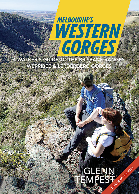
Great news. Our newest title, Melbourne’s Western Gorges, arrived in our warehouse this morning and will be in the shops from tomorrow. Authored by Glenn Tempest, this is the first in a new A5 series of walking guides to regional areas around Victoria. Melbourne’s Western Gorges covers 20 walks in the Brisbane Ranges National Park, and Werribee Gorge and Lerderderg State Parks. Produced in full colour with 96 pages it retails for just 19.95. Like our last book, Daywalks Around Victoria, this guide also features free GPS downloads as well as regular updates. Melbourne’s Western Gorges is also available in our online bookshop.