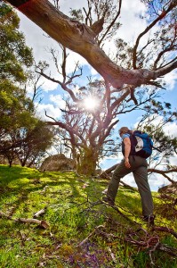
 Walk 2 (Lorne Forest Walk)
p16. Kalimna Falls Walking Track and Link Track are currently closed. You can complete the walk by following Garvey Track (from Sheoak Picnic Area) to Sheoak Track. The alternative walk (Sheoak Picnic Area to Swallow Caves) is also closed. Check out http://www.parkweb.vic.gov.au for further details.
Walk 4 (Around Aireys Inlet)
p24. Currently there is no access to Painkalac Reservoir, including along the walking trail from Distillery Creek and Moggs Creek picnic grounds. We have been told it will reopen within a few months. Gentle Annie and Moggs Creek Tracks are closed. Check out http://www.parkweb.vic.gov.au for further details.
Walk 6 (Major Mitchell Plateau)
p32. The road up to Mt William is currently closed due to flood damage. This walk is therefore closed at the moment. Check out http://www.parkweb.vic.gov.au for further details.
Walk 7 (Mt Rosea and Sundial Peak)
p38. The road up to Sundial Carpark is currently closed due to flood damage. This walk is therefore closed at the moment. Check out http://www.parkweb.vic.gov.au for further details.
Walk 9 (The Fortress Caves)
p50. The Victoria Range and surrounding vehicle access tracks are currently closed due to flood damage. Buandik Campground is also closed. This walk is therefore closed at the moment. Check out http://www.parkweb.vic.gov.au for further details.
Walk 13 (Langhi Ghiran)
p68. Lagoon Track and Link Track are closed due to flood damage. This walk is therefore closed at the moment. Check out http://www.parkweb.vic.gov.au for further details.
Walk 17 (Clearwater Creek)
p90. Clearwater Creek is correctly known as Watties Creek according to the Parks Victoria website. This makes much more sense. The confusion appears to have come from the 3rd edition of Meridian’s Lerderderg & Werribee Gorges map which calls it Clearwater Gully. There is already a Clear Water Creek just north of O’Briens Crossing.
Walk 19 (Pyrites Creek)
p98 There has been some trail maintenance done in Wobbly Gully during Autumn 2011, which has made the trail much easier to follow.
Walk 20 (Mt Kooyoora)
Kirwans Track and Mount View Road are currently closed to vehicles due to flood damage. These tracks may still be open to walkers. If so you should be able to start and finish the walk at Melvilles Caves Campground. Call Parks Victoria or check out http://www.parkweb.vic.gov.au for further details.
p103. The campground mentioned is Kiata Campground, this is a mistake as Kiata Campground is in the Little Desert! Obviously it should be Melville Caves Campground (which has no shelter or water).
Walk 25 (Cathedral and the Jawbones)
p124. The map icon places the Cathedral Range incorrectly.
Walk 27 (Pine Mountain)
p136. Pine Mountain is a return walk, not a circuit.
Walk 29 (Mt McDonald)
p146. The fire trail between Low Saddle Road and North Ridge Saddle appears to have become overgrown (post fire regrowth) and is no longer easy to follow.
Walk 31 (Mt Feathertop)
p161. The map indicates Federation Bungalow Site. This should be Feathertop Bungalow Site.
Walk 35. (Cape Liptrap Coast Walk)
p178. According to Parks Victoria Five Mile Track is ‘closed until further notice’ (http://parkweb.vic.gov.au/explore/parks/great-otway-national-park). It’s always been very wet during the winter months but it’s obviously got a lot worse. The access path from the lighthouse road to the beach was a little bushy (and steep at the end) but was never a real problem. Looks like things have changed. The grading of the walk is now probably difficult. I suspect that as less people visit this remarkable stretch of coast the walking trail along the top of the limestone cliffs will also get more difficult to follow.
Walk 36 (Oberon Bay)
p184. The southern park of the park (beyond the airbase, 14km within the park) is closed due to recent flood damage. This walk is therefore not accessible at the moment. Check out http://www.parkweb.vic.gov.au for further details.


Walk 17 (Clearwater Creek)
p90. Clearwater Creek is named as Watties Creek according to Parks Vic website http://parkweb.vic.gov.au/__data/assets/pdf_file/0019/313633/map26.pdf
Hi dplus. You are quite correct that the Parks Victoria website map calls this Watties Creek. This makes much more sense. The confusion appears to have come from the 3rd edition of Meridian’s Lerderderg & Werribee Gorges map which calls it Clearwater Gully. I don’t have my previous editions of this map to check if this is a long running error or not.
Hi There
Completed the Major Mitchell Plateau walk ( Walk 6 from Daywalks Around Victoria ) this weekend – sadly, the fog and mist did not lift for the whole day. However, can confirm the road to Mt William is open.
Also completed the Fortress Caves walk ( Walk 9 from Daywalks Around Victoria ) and can confirm the walk is currently open.
cheers
Andrew
Walk 17 (Clearwater Creek).
Some comments on this walk. I organised a group of nine to do this walk. It took us 8.5 hours to complete the walk, and we were pretty exhausted at the end of it.
I thought the walk description underplayed the difficulty of the walk (it did mention it was difficult, and mentioned there were no formed tracks for a large part of the walk, however most of the description seemed ignore this). The river section of the walk is very tough and very difficult to make progress. Lots of bushes and fallen trees made walking very slow. That’s OK, just that it would have been good to have that described better (and the walking time moved to 7 hours – no way it is 5 hours).
The section after the Lerderderg Track ends and before reaching the Lerderderg River is really difficult to follow. Even with a GPS, we got lost and ended up at the Lerderderg River about 400m away from the intended intersection. It was not altogether a bad thing, there was a lovely pool there where some of us swam.
The other thing is that this is one of the rare walks where a GPS is absolutely essential. We all lost track of where we were in the river, so many bends, so hard to track progress and the lack of any really visible landmarks. If it wasn’t for my GPS, we would have all been lost. My advice to all other walkers is that unless you are a whiz with a map and very experienced, bring a GPS with you.
However, that said, it was a nice walk. Very scenic. Just don’t expect to make quick progress through the river, allow more time for this.
Walk 4 Around Airey’s Inlet
There is now an underpass at the Fairhaven Surf Lifesaving club, so walkers now only need to cross the Great Ocean Road at one point on this walk. Also, the signage at the turn from Gentle Annie Track onto the Private Property section of the trail down to Moggs Creek Picnic Area no longer reflects that walker’s are welcome to enter.
Walk 17 Clearwater Creek
Agree with Simon Andersson that the duration of this walk would be more reasonably set at 7 hours, with potentially a bit more emphasis on how difficult it is, and a GPS all but required. We didn’t get lost, but we did find LOTS of snakes [my husband would have preferred to get lost.]
Walk 16 Werribee Gorge
I noticed today for the first time that there are new “no access” signs on the two short private land sections of the larger round trail that crosses the river. There are also new signs from Parks Victoria indicating that the private land is not accessible. Do you have any info about this? I have done this walk a couple of times and there was never any issue with private land access before?
Thanks, George
Hi George,
I’m sorry to hear about the ‘no access’ signs on the walking trail in question. This is one of the best walks close to Melbourne and I feel very disappointed that Parks Victoria could not arrange for walkers to use the existing trail. I’m afraid this is a sign of the times. Over the years I have seen more and more walking trails closed down. The situation in Werribee Gorge is particularly upsetting as half the gorge is privately owned. Thank you for letting me know. Cheers, Glenn
Hi Glenn. Walk 23 Dandenong Ranges. Your map shows start/end at cnr Ridge Rd and Mt Dandenong Tourist Rd. Should be Range Rd and Mt Dandenong Tourist Rd i.e. your map incorrectly labels Range Rd as Ridge Rd at this intersection. You do show Ridge Rd correctly as intersecting Mt Dandenong Tourist Rd further north. The walk instructions avoid this confusion. Regards Fred
Hi Glenn,
Tried walk 23 yesterday and it is still difficult to complete due to the storm damage in the Dandenongs from a little while ago. Mechanics Track (Doreys Bridge to Ridge Rd, linking East and West sides of the loop) is out of action. Cheers, Steve