Posted on Leave a comment

Parks Victoria Halts New Grampians And Arapiles Guidebooks

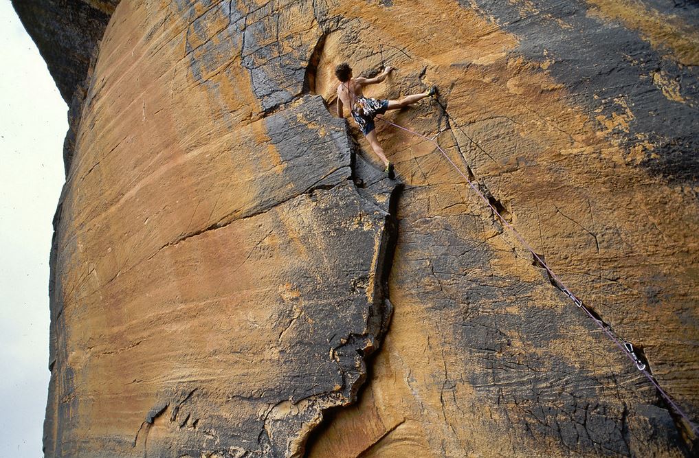
To all of our loyal wholesale and retail customers it is with a great deal of regret that Open Spaces Publishing has made the decision to halt work on all of our planned rock climbing and bushwalking titles for the Grampians National Park and at nearby Mt Arapiles.

Our business moved to Natimuk in the Wimmera almost 7 years ago to concentrate on climbing and bushwalking publications and I would like to think that our guides have been of some importance to the tourism industry. Over the years we are proud to have printed and sold well over 110,000 of our own Open Spaces titles, generating over 5 million dollars in retail sales and helping to support numerous authors and small businesses. We had a number of climbing guides to the Grampians in various stages of production and had started work on the fourth edition of our very popular Arapiles Selected Climbs guide which was scheduled for release in about 18 months.

There is no doubt that the massive Grampians climbing bans (on an unprecedented global scale and which have come into force over the last 18 months) combined with the recent Bundaleer and Taipan Wall climbing and bushwalking bans, have forced Open Spaces to re-evaluate our position. In these uncertain times and given the likelihood of further climbing and bushwalking bans in both the Grampians and at Mt Arapiles we have decided to cease all of our planned publications to these areas. A business like ours cannot be expected to operate where there is no certainty. We are especially disappointed that Parks Victoria and the Traditional Owners have decided not to engage with the climbing and bushwalking communities and instead continue to foster this uncertainty. Our own recent discussions with senior Parks Victoria staff regarding our forthcoming Grampians bushwalking guidebook have also given us further cause for concern.

Open Spaces would like to offer our full support to all of the various rock climbing, bushwalking and reconciliation groups working towards a mutually beneficial outcome. We understand and are upset that this decision will directly effect the flow of tourism dollars into our Wimmera and Grampians regions but we feel we have no choice. This decision does not affect our existing publications and we will continue to act as a wholesale and retail distributor to titles on our current stock list.

Posted on 1 Comment

Following the Wombat Poo Trail

Wombat poo and flower

Over the years I’ve developed a fascination for wombat poo. Nothing weird, more as a subject matter for my camera as opposed to collecting them for things like making paper with (which is apparently done commercially by some mob down in Tassie!) My native Victoria is home to many thousands of wombats and this amiable ambling marsupial is a common sight when visiting our parks and reserves. There are a few things about wombat poo that make it so interesting. Firstly, the poo is essentially square. That’s right, a fresh poo is pretty much cube-shaped. It boggles my mind that somehow a wombat’s intestine can knock out square-shaped poos. Also, wombats love to do their poos on top of things. On top of stones, logs, mounds and even low fence palings. Which is why they need to have their poos square-shaped – so they don’t roll away! Wombats pump out between 80 and 100 of these marvelous marshmellow-sized wonders each night. Not a bad effort. They place them in conspicuous positions to tell other wombats that this is my place so stay well away. Over time the poos melt back into the bush, back into the grass from whence they came. HERE is a bunch of my wombat poo pics (linked to my SmugMug site) to browse through – if you are so inclined…

Posted on 2 Comments

When Is The Best Time To Walk The Overland Track?

Warwick Sprawson is our guest blogger. He is the author of  Overland Track which is available for purchase in our bookshop. Here, he asks the question – “When is the best time to walk the Overland Track?”

The ‘best’ season for hiking Tasmania’s Overland Track is as personal as your scroggin mix. Some thrive on the cold and solitude of winter, others on the long days and bustling huts of summer. Each season has its pros and cons.

Summer
Summer is the most popular season to walk the track. Many wildflowers are in bloom, carpeting the plains in vivid colours. The days are long, providing more daylight hours in which to tackle the track’s interesting side routes – trails off the route’s main spine. The average maximum temperature is a relatively warm 16.3°C, with temperatures in the 30s not uncommon. Summer also has the least rain, about as half as much as winter.

Your best chance of a view is in Summer. View from Barn Bluff

The downside of hiking in summer is that the huts and campsites are often busy, although the booking system – which runs from 1 October to 31 May – ensures the track is never overrun. If you want to hike in summer make a reservation early; the track is often fully booked from December to late January. In peak season you have to walk the track from north to south (Cradle Valley to Lake St Clair).

Inside Kia Ora hut. Huts can get crowded in Summer

Autumn
Autumn on the Overland is under-rated. Hikers can enjoy the spectacular golds and reds of the deciduous beech trees, usually at their best around Anzac Day. Apart from the Easter period, the track is less crowded than summer, and there can still be fairly good weather, especially in March. The first significant snow often falls in May (but snow can fall anytime on the Overland, even during the height of summer).

sign at Kia Ora Creek, April

Deciduous beech
Deciduous beech

Autumn. Late afternoon near Pine Forest Moor

One of the best things about autumn hiking is the variety of fungi. You’ll see a huge range of shapes and sizes, the bright reds, oranges and yellows lighting up the dim rainforest.

Fungi near D'Alton falls
Fungi near D’Alton falls

Autumn fungi
Autumn fungi

Winter
Winter on the Overland is only for the hardcore. It snows frequently enough that the route can be hard to discern, especially in white-out conditions. Taking snow-shoes is advisable. The days get dark by 5pm, so there is less time to do sidetrips. Overnight temperatures can be as low as minus 9°C. Winter also has the most rain, making the track even wetter and muddier than usual.

Climbing the Acroppolis in snow. They had to turn back.

On the other hand, in winter it’s likely that you’ll have the huts along the track to yourself, and be reasonably snug thanks to the coal or gas heater. You also have the freedom to walk the track in either direction and don’t have to pay the $200 Overland Track booking fee which is required during peak season. Winter also provides the occasional crisp, clear day which reveals the full majesty of the snowy landscape.

Spring
September and October are usually the windiest months, with the conditions becoming more stable in November.

Tasmanian Waratah
Tasmanian Waratah

Some flowers, such as the Tasmanian waratah, begin to flower in late spring. In September you can walk the track in either direction and save yourself the booking fee.

As you can see, every season has its advantages and disadvantages. So what’s your favourite season to hike? Why?

Warwick Sprawson’s Overland Track guide is available from the OSP bookshop for $19.95. The full-colour guidebook includes track notes, maps, flora, fauna, history and geology.

Posted on Leave a comment

El Chorro – Camino del Rey

El Chorro
El Chorro

I love travelling from place to place and it suits my propensity for boredom – doing one thing for too long. Having said that though, I am a homely creature in many ways and love to find a spot to settle in and call home even if for only a little while.  It’s a constant fight in my head really. So the opportunity to stay still for a little longer was appealing and El Chorro in Malaga was it! El Chorro is a small village in Andalusia, southern Spain. Being located next to the Desfiladero de los Gaitanes (“Gorge of the Gaitanes”)  means that rockclimbing is pretty high on the things to do list in the area. No denying that we were there to sample that but there were other delights of the area and the the Camino del Rey (being a climber helps)  was a definite for me. More on that later.

Gorge at El Chorro Camino del Rey

Granada, which houses the Alhambra (design obsession coming to the fore again) is two hours away so rather than stop and stay overnight there, we decided to do a day trip from El Chorro. Stay tuned for my Alhambra experience – look away if you don’t like architectural and archeological design! More of that in another blog post.

Railway bridge at El Chorro

We had obviously timed it just right as the roads in the area had only just opened after being washed away from the floods over the past couple of days we were in the Costa Blanca. There were tell tale signs as we drove closer, of mud washed houses and deep ruttings in the olive plantations situated on the steep hillsides.  People had been working diligently in order to get these narrow roads open.  For many of the smaller villages in the area, these roads are vital.  I am glad we drove in whilst in was still light.  It allowed us to see the washed away and collapsed sides of the road.  This meant that we were at least aware of them when driving along them in the dark for the following week. Always important to know when the road is really only wide enough for one car. My girly protestations of not playing chicken with the other oncoming car were thankfully taken on board by Cam.

We stayed at La Finca La Campana which I have to say was a great choice. A choice of accommodation options is on offer, camping, bunkhouse etc but we chose one of the great little bungalows. I am an interior and design obsessed climber so whilst I am more than happy to just camp wherever there is a bed, I do love to stay where my eyes can feast on interesting details. So indulge me here for a moment. A cute and quaint little bungalow with Spanish and Moorish little design details, painted white stone and shuttered windows to lock out the hot midday sun. A private courtyard with wrought iron doors. Nothing fancy mind you – just a rustic moorish feel to the residence. Perfect for whipping up a quick meal after a day at the cliff, sipping on a Spanish red and planning the next day by spreading guidebooks across the hand hewn table. A pool with slackline about 10 metres away, a number of shared community recreation areas, bar, kitchen, small shop and regular visits of resident cats that will either give you the attention you want or leave you alone. I’m a cat person so loved sitting down with my glass of wine whilst attending to the needs of the finca’s cat population.

Cam being clever on the slackline

First morning saw us waking up to a sunrise fighting it’s way through the low lying mist. There was a lovely calmness about it and I just knew that we were going to have a great week. We chose to start off our climbing adventures in a nearby area that was home to a variety of climbs from 4a up to about 7a.  Once again, after a few quick warm-ups which were pretty unmemorable, we jumped on a couple of 5b+ and 6a’s. These were much more enjoyable but the sun was starting to develop it’s bite for the day so it was time to head off for less strenuous activity. When I say less strenuous, I don’t mean, chilling out on the lounger by the pool.  I mean climbing and walking along the Caminito de Rey. (the Kings little path).

Cam at the start of the Camino del Rey

This was  a path built along the gorge walls in 1905, that  gave access to a hydro-electric plant and took its name after an official visit by Alfonso X111 of Spain in 1921. In quite a dilapidated state, it was officially closed to the public in 2000 by removing some of the path access at the start. There are numerous reports that people have died on the walkway but from my research, whilst people have died, it hasn’t been because of the state of the walkway, or from it collapsing. More from human error such as a tyrolean traverse that went wrong.

Tracey crossing the start of ca
Tracey crossing the start of the Camino del Rey

Being a climber, and also someone who has no issue with heights, my experience would no doubt be different to someone who doesn’t climb much and who does feel nervous at heights. I am not going to go into too much detail about the complete access as that would be a complete blog in itself but basically, the first part is the sketchiest. You need to access it via a number of steel posts that stick out from the cliff.  There is a thin cable that has been installed so you can use it as a via ferrata of sorts. This first section does require you to hug the cliff face and take steps of about a metre apart to reach each steel post.  Once you have passed this section and up a number of stacked blocks you reach the walkway proper. As you can see by the photos, some sections of path are ‘solid’ whilst other bits are ‘holey’. Another missing section of path requires you to step long and reach long.

Cam crossing the void


For long limbed ‘ape factor’ people like Cam, not a problem.  For short limbed normal people like myself it was reachy. Still not an issue for me though – I loved it.

Tracey over the void

As the day was hot, walking the path was a cool adventure. Both in terms of temperature and of awesome rating. For me, I would recommend doing it if you had the chance. From reports, it appears that the pathway will be rebuilt to make it safe and accessible for all. Inevitable I suppose, considering the interest in it, but no doubt the element of fear or adrenaline that people may experience in its current condition will be lessened.

Tracey on Camino del Rey

For those interested in the history of this kind of infrastructure, it really is a great spot to visit. Walking along it and seeing the various little caves and tunnels that were used by the workers throws your mind back to the goings on of the time. And might I say, there are a couple of cool looking climbs you can access from there. Just a couple of grades out of my current reach though. Next time……

Boy, was I tired at the end of that day. One glass of red, plate of rice, beans and chorizo, a pat of the brutish but friendly beaten up tomcat that I named One Ear Malloy and the bed was calling my name. I collapsed. And I think there was a smile on my face.

Sunset at El Chorro
Sunset at El Chorro

Posted on 5 Comments

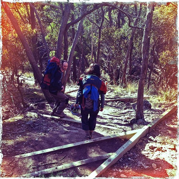
Australian Alps Walking Track: 4 Days

Ben Spencer is our guest blogger.

Day 1: Walhalla to O’Sheas Mill Site (13km)

The Walhalla Pavilion – the starting line.

Much dreaming came to fruition when dad and I tackled the first 45km of the Australian Alps Walking Track (AAWT) over the last Melbourne Cup weekend. We met in the historic town of Walhalla and immediately organised a car shuffle with our two cars. It took us an hour to drive along the Thomson Valley Road to Stronachs Camp – the chosen endpoint of our walk. Luckily, I had pinpointed the camp on the GPS because it was innocuous and would have been easily missed. Leaving my car, we headed back to Walhalla in dad’s car. After just ten minutes our excitement was deflated when a sharp sound heralded the arrival of a flat tyre. The dirt road sloped away towards a gully and although it wasn’t ideal for changing a tyre, dad rolled up his sleeves and got stuck into it whilst I searched for the hub cap that had shot-off in the incident. Back in Walhalla we lunched and made final pack adjustments.

Climbing steeply up from the Walhalla Pavilion (and clutching a copy of John Chapman’s Australian Alps Walking Track guidebook), we followed the walking trail as it snaked away from the township and into the forest. Light cloud covered a warm sun, which provided ideal walking conditions as we slowly built up momentum in our pace. The flat gradient was extremely pleasant and we soon arrived at Poverty Point Bridge spanning the Thomson River.

The historic 1901 Poverty Point Bridge.

We rested a while on the bridge, snacking and enjoying the view as the river meandered peacefully below. Afterwords we climbed high above the river, soaking up the views. Eventually the gradient increased and our heavy packs contributed to us puffing heavily as we willed ourselves upwards. After what seemed like an age, the trail arrived at a sealed road that we had driven along earlier. The AAWT crossed the road and headed straight back into the bush. We wandered downwards, still recovering from the ascent and shortly arrived at our camp for the night – O’Sheas Mill Site (East Tyers Campground). It was a lovely tranquil spot next to a rushing creek and provided an ideal place to rest for the night. Unfortunately, it was also accessible by car and we were dismayed when a group of ‘bush bogans’ arrived to party noisily into the night. A fellow walker, on his first day of hiking the entire track, had also set-up camp and seemed equally annoyed about their presence. Luckily we found a small camp pad next to a cascade of water, the noise of which helped to drown out the hooligans.

Ferns on the grassy banks of the East Tyers River.

After setting up our tent we cooked a hot meal and discussed the task facing us in the morning. We were to embark upon the longest continual climb to be encountered along the entire 650km AAWT. Sufficiently tired from our days walking, we thankfully crawled into or sleeping bags and fell asleep.

Day 2: O’Sheas Mill Site to Talbot Hut Site (11.7km)

We emerged from our tent before 7am and to our surprise some of the ‘bush bogans’ were already up. They had stoked their campfire to bonfire proportions which led us to believe that they hadn’t gone to bed at all. Our friend attempting the whole track was still abed – a role reversal from what I’d expected. The night had been milder than anticipated, perhaps because we were still at low altitude. We pottered around camp, gradually disassembling our gear and arranging it into our packs like a jig-saw puzzle. To our surprise, the ‘through walker’ said his goodbyes and was underway well before us. No doubt, he’d packed up camp a few times in his walking life and developed an efficiency we clearly lacked. Eventually we got underway and immediately encountered our first major obstacle. The East Tyers River required us to remove our boots and brave the icy waters in bare feet. With thoughts of blood sucking leeches, we struggled over the creek grimacing at the freezing temperature of the water.

Crossing the East Tyers River is a refreshing way to start the day.

The trail now started its long climb towards the mountain tops. After an hour or so, and just as we were getting into an enjoyable walking rhythm, I had a dramatic revelation. I’d left my car keys in dad’s car. This would mean, at the end of the walk, we would arrive at my car and be locked out! Considering our options (or lack of), we decided I would walk back and get the keys whilst dad continued on alone. The plan wasn’t without its flaws – dad would be without a map and I would need to walk over 30km in a day. I hid my pack in the bush, knowing I’d be back for it, and headed back towards Walhalla. With adrenaline pumping and minus my pack, I made quick progress. A black snake languished across the path and thankfully I was alert because its lack of movement gave it a strong resemblance to a stick. Although aware of my presence as I crept close for a photo, the snake made no move to exit the scene. I attributed this to him being in the shade and having not yet gained the solar power required for fast movement. About 5min passed and he eventually stirred into action and casually slid into the undergrowth.

A black snake, not to be mistaken for a stick!

The day was heating up and having covered over 12km already, I slowed to a brisk walk as the initial excitement passed. About 2.5 hours after I turned back, I arrived back in Walhalla to find it filled with tourists. To my relief, my car keys were in dad’s car and my efforts hadn’t been in vain. Rather than walking the entire way back to my pack, I drove dad’s car 20 minutes back to O’Sheas Mill Site (East Tyers Campground) – one benefit of road access to the site. A couple of fellow walkers were lunching at the picnic table; I assumed they had come from the direction I was heading in. After recrossing the East Tyers River for a third time I arrived back at my pack. Here I took a much needed lunch break, rudely marred by mosquitoes and other stinging insects. I sighed at the injustice, lathered on the sunscreen and mentally prepared myself for the massive climb ahead of me. The trail gradient now quickly steepened and the foliage tightened around the track creating a suffocating feeling.

The trail continued always upwards.

The humidity was high and sweat streamed off me. The climb was unrelenting, becoming an exercise in mental and physical endurance. I passed a family heading downhill who offered information on the walk ahead – I didn’t want to know. Eventually the trail spat me onto a dirt road and although the steepness lessened it was still all up. The occasional car zoomed past, lessening the wilderness feel. Finally I arrived at a small carpark, from where the the popular Mushroom Rocks Walking Track begun. I encountered some other hikers and asked whether they had seen dad. It was a relief that they had. The trail-head signs indicated that I had another 2.5 hours of walking, disheartening news as my energy levels had dwindled. The AAWT continued on towards Mushroom Rocks, winding ever upwards. Climbing over and under fallen trees sapped my strength even further. The trail eventually wove through Mushroom Rocks, large boulders scattered amongst trees like giant marbles.

Moss-covered granite marbles at Mushroom Rocks.

I didn’t linger at the rocks as I wanted to tackle the steep climb up and over Mt Erica before it grew too late. The air temperature now grew noticeably cooler as the constant ascent continued. After what felt like an eternity I lifted my head to find the trail had finally flattened and a wooden sign beckoned me closer. My spirits soared. Surely this must be the top. No such luck, however. The sign tantalisingly pointed out that Mt Erica was still some way ahead of me.

The sign that mocked me.

I was now mentally and physically exhausted but I put my head down and kept trudging upwards through the snow-gums. Finally another sign came into view. It was Mt Erica. I had made it. The trail gently rolled into Talbot Hut Campsite where I found dad relaxing and enjoying a cup of tea. We recounted the day’s events. Dad had talked to walkers he had met during the day who helped keep him on the right trail. He’d found the ascent as tough as I did and we were both glad it was behind us. The campsite was situated next to a lovely trickling mountain stream and was protected from the wind by the snow-gums. We spent the rest of the night enjoying a well-earned meal and were in bed shortly after dark.

Day 3: Talbot Hut Site to Mt Whitelaw Hut Site (12.5km)
Despite our weariness, we both slept restlessly, still unaccustomed to sleeping on the ground. We made good time getting up and away, having become more efficient at packing our gear. The day’s walk began with slight rises and falls as we crossed the Baw Baw National Park. Our progress slowed considerably as we were forced to walk through ever larger pools of water. Thick scrub often prevented us from going around and soon our feet were drenched. Eventually the trail reached large patches of snow, a surprise as this was November. The increasing amount of snow did, however, explain why there was so much water on the lower trail. Luckily the yellow markers on the trees ensured that we didn’t lose our way.

Maybe we should have brought the skis!

Just past the Mt St Gwinear junction we encountered some other walkers making their way from Baw Baw Village to Mt St Gwinear. A gradual climb followed, which soon brought us to the highest point within the Baw Baw National Park – Mt St Phillack at 1556m. Unfortunately any views of the surrounding mountains were obscured by the snow-gums.

Not much of a view from Mt St Phillack.

We sauntered downwards until dad called a halt for lunch on an outcrop of rocks. Whilst we enjoyed a food and rest break, an ultra-marathon runner appeared out of nowhere, geared up and running in the opposite direction. Dad yelled out to ask where he’d come from. ‘Red Jacket’, he shouted, as he was swallowed up by snow-gums. A quick look at the map confirmed that he’d already covered 37km and that he probably had many more to go. After lunch I became impatient and scouted ahead, sure that we couldn’t be far from our overnight stop – Mt Whitelaw Hut Site. Sure enough I came upon a crumbling chimney with flat campsites scattered around. Waiting for dad to arrive, I explored the water options and discovered it to be more swamp than stream. Definitely not the robust flows we’d been blessed with previously. I squelched through a soggy marsh to find a trickle of fresh, icy water – it was worth the effort. Dad soon arrived and we set up the tent. Being mid-afternoon we took our time savouring the serenity and reflecting on the journey thus far. Again we were in our sleeping bags just after nightfall, serenaded by the croaking of frogs calling to each other in the swamp below.

Our piece of paradise at the Mt Whitelaw Hut Site.

Day 4: Mt Whitelaw Hut Site to Stronachs Camp at Thomson Valley Road (9km)
We were up at sunrise, wanting an early start on the last day’s walking. The trail was now mainly downhill and soon we left the snow-gums behind. As we crossed a small hill we were treated to our first long-distance views since day one. Overlapping mountain ranges vanished into the horizon.

Views, Glorious Views.
Views, glorious views.

We continued steadily downwards, reaching a grassy gully surrounded by dense scrubby undergrowth. Inevitably the trail climbed again out of the trough and widened before climbing past a junction to the Upper Yarra trail, which I have to say looked overgrown and uninviting. Cresting the hill, we promptly rolled downwards again as the surrounding trees slowly transformed into tall mountain ash. We were making good time now as we descended rapidly. We came to a sign and a campsite just before Thomson Valley Road and knew the end was nigh. Reaching the road, we craned our necks to check the car was there and thankfully it was. Back-slappings and celebrations ensued – we had made it. Despite the hardship of the second day, the walk was a memorable experience that I will always treasure. It made me realise the act of walking and camping in remote wilderness is a pleasure in itself and spectacular scenery is an added luxury, not a necessity.

Posted on Leave a comment

Victoria’s Goldfield Walks On Sale Now!

Great news. Our newest title, Victoria’s Goldfield Walks, arrived in our warehouse this morning and will be in the shops from tomorrow. Authored by Glenn Tempest, this is the second offering in a new A5 series of walking guides to regional areas around Victoria. Victoria’s Goldfield Walks covers 20 walks in the central Victorian Goldfields around Bendigo, Ballarat, Castlemaine & Daylesford.

Produced in full colour with 96 pages it retails for just $19.95. As with our last two books, this guide also features free GPS downloads as well as regular online updates. Victoria’s Goldfield Walks is also available in our online bookshop.

Posted on 4 Comments

Three Days Along the Great Ocean Walk

Ben Spencer is our guest blogger. Images by Grant Hawkins.

Day 1 – Milanesia Beach to Ryans Den

With much anticipation we were finally bound for the Great Ocean Walk – a 90km snaking trail along the Victorian coastline from Apollo Bay to The Twelve Apostles. Our crew comprised of my dad and three mates and we intended to tackle the last 40km stretch of this famous trail, linking Milanesia Beach to the Twelve Apostles. After about 3 hours driving from Melbourne, we turned off the Great Ocean Road onto a steep dirt track more suited to four wheel drive vehicles. Our two-wheeler managed okay, but I wouldn’t recommend trying it in the wet! The rough track abruptly ended with breathtaking views over imposing sea cliffs that dropped into an expansive blue ocean.

Eager to crack onwards, we shouldered our heavy packs and hit the trail, which almost immediately got really steep as it descended to secluded Milanesia beach. It was quickly obvious that the only way onwards was up and, once again it was very steep! A pattern was quickly forming and the lads pondered aloud what they’d got themselves into. The hot sun was beating down, the climb was arduous on untrained limbs, our packs were heavy and we’d only just started! After an extended and challenging ascent, we struggled to the crest of a hill and found the perfect vantage point for lunch. The outlook was spectacular and was everything I had envisaged when dreaming of the walk. Most definitely a ‘lunch with a view’. Note to self – stow food in an accessible place to avoid unpacking the whole rig whenever I got hungry.

With lunch done and plenty of sunscreen applied, we headed off again knowing it was only a short day of walking. The remainder of our hike through to camp was as steep as it had started and we were very pleased to drop our packs on arrival. We’d been told the camp was booked out but contrary to this we found it empty except for one other party. We chose a great campsite screened by shrubs and within a few steps of stunning outlooks over cliffs and ocean.

Having set-up camp without too much issue (I feared my tent looked a bit small for two lads) we went about the next order of business; dinner. Pizzas were on the menu and in no time at all we were enjoying our feast and soaking up the amazing vistas surrounding us. The remainder of the evening was spent boiling water from the tank to kill potential bacteria, waiting for it to cool and filling our drink bottles. This process took a considerable time because we needed a fair bit of water.

Day 2 – Ryans Den to Devils Kitchen

Sleep had been hard to come by, probably due to a few factors – the hard ground, the warmth of the night and the unfamiliarity of sleeping in a tent. Rain had swept through at 4am and we had to rescue some items that had been left outside, including my bag – another lesson learned. We were up at 6am and away by 8am. We needed to get away early so as to arrive at the beach section of the walk at low tide. The day’s walk started much the same as yesterday with lots of ups and downs but with amazing views as the reward for having gained the top of each climb. The notes listed this section as the hardest of the walk so we knew a big day was in store. Dad got his pack sitting better so that his hips were taking the weight, which he said felt much more comfortable than the previous day. Everyone was in good spirits and we made good time as the landscape varied from cliffs to paddocks to bush and back to cliffs again.

The trail was well worn and there was no chance of getting lost but it resulted in a lack of wildlife – animals seemingly knew to stay well away. Eventually we arrived at a set of stairs that lead to the beach segment of the walk – we had timed things perfectly as low tide was reported to be at 11:47am and we had arrived at 11:45am. The map listed the staircase as 364 steps but I didn’t let the lads know because a few were fading with at least 12km of territory already covered for the day. Arriving at the beach, we could see why it was necessary to traverse it at low tide – there was very little sand between the cliff and the water’s edge and high tide would leave no sand uncovered. Waves crashed over exposed reefs and we explored the rock pools as we ambled along the beach – losing our haste and enjoying the moment. Remains of two old ship wrecks, including an anchor, were a reminder of how devastating and unforgiving this wild coast could be.

We continued along the beach until spotting the trail heading back up the slopes. At this juncture, we stopped for lunch on the beach, satisfied that we’d broken the back of the days walking and had only a short section until camp. A liberal coating of repellant warded off the march flies and allowed us to soak up the serenity of this isolated beach. It was also an ideal place to tuck into a big lunch. The last tiring climb was a steep one and we were relieved to finally reach our campsite, a place we all agreed equaled the previous nights ‘wow’ factor.

We took our time setting up camp as we had arrived mid-afternoon and there was little else to do except relax, take pictures and get cricket updates – Clarke made over 300 runs against India. Dinner time came around and I happily cooked the grub I’d been carrying for two days. The meal was well received by the boys and all the food was polished off (next time I’ll bring more noodles!). With dinner done, we set about boiling more water for the following day, which fortunately didn’t take as long as the previous night. As the sun sank low in the sky we ventured down to the beach for a quick dip, though the ever-present reef stopped us from venturing too far out.

Day 3 – Devils Kitchen to The Twelve Apostles

We were up at 6am again and away by 7:30am. Faster this time and keen to walk in the coolest part of the day. The route was much flatter and the troops enjoyed this style of walking a lot more. We left the cliff-tops behind for a period as we moved into the typical Aussie bush that I’m more accustomed to. This change in vegetation necessitated the cleaning of our boots in a washing station to stop the passing of cinnamon fungus (phytophthora cinnamomi), a nasty pathogen that attacks tree roots. Soon afterwards we reached the exposed cliff-top again and encountered a person at one of the view points, which was the first sign we were nearing the end of the walk. At this point, foliage was growing over the track, making things difficult – for some reason the rangers had neglected to maintain this section. Long pants would have been beneficial but it was too hot to wear them so we endured. Eventually we pushed through into a clearing to be greeted by superb views of the Gellibrand River snaking past Princetown Recreation Reserve – our finishing point.

Before long we were back at the car with plenty of back-slapping and congratulations. It was a further 6km to the Twelve Apostles and we decided to complete it on foot – leaving the packs in the car of course! The views walking towards the Twelve apostles were memorable and provided a totally different perspective when compared to the usual driving approach.

Arriving at the first apostle we ventured down to the beach to look up at the massive rock tower. Strangely the track petered out at this point, despite the map saying it went for another kilometre to the Twelve Apostles Information Centre. Not to be deterred, we finished the last little bit along the road and made it to the end! It was an amazing trip where jaw-dropping views became the norm – I certainly recommend this walk to anyone considering it.

Posted on 8 Comments

Escape to the Beeripmo Walk

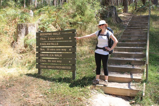
Ben Spencer is our guest blogger for this week.

The First Day, Up, Up and Up!

The luxury of a long weekend presented the ideal opportunity to undertake the Beeripmo Walk – a 21km, two-day hike. Located about an hour’s drive west of Ballarat in the Mt Buangor State Park and Mt Cole State Forest, the walk promised to be a great introduction to what is one of Victoria’s lesser known bushwalking destinations. A major enticement was the walk-in campsite which could only be accessed by foot and which we hoped would provide us with a tranquil overnight setting.


My partner Aislin and I arrived at Richards Campground, the beginning of the walk, at about midday after a 2.5 hour drive from Melbourne. Surprisingly there were only two other cars in the carpark. We began our hike in the heat of the day – the sun beat down mercilessly as the track climbed steadily up through the forest. The going would have been challenging enough on a normal day but the heat combined with the weight of our backpacks meant that it turned into a slog. After about 30 minutes walking we managed to make it to the first point of interest, Raglan Falls. At the top of the falls we took the opportunity to throw off our packs and rest. There was little more than a trickle of water but the sound was soothing.

We couldn’t put it off any longer and eventually we shouldered our packs and continued the climb. The trail notes had listed this walk as for a moderate fitness level, which perhaps it would be without our heavy packs. As we approached Cave Hill the steepness of the trail abated for a time but still continued gradually upwards. Glimpses through the trees allowed us to gauge our altitude and a short time later Grevillea Lookout provided us with uninterrupted views of Mt Cole in the south and of the Western plains below. A higher mountain rose to the right of us which could only be the Sugarloaf, which was to form the next goal on our walk.

The rationale behind the naming of the Sugarloaf quickly became apparent as the track rose sharply – it was akin to a sugar cube bobbing in a cup of tea. After our earlier exertions, the climb was now even more challenging and our pace slowed considerably. The track wound back and forth up the cube – no doubt because heading straight up it would have required climbing gear! The path had definitely not been used that day because webs guarded by large spiders continuously blocked our path. A baby brown snake sunning itself on a tree stump was surprised by our appearance and hastily slithered back into the undergrowth. Eventually we struggled to the top of the Sugarloaf and rested for a while as we took in the vista.

It had been a very tiring day, the heat of the sun had thankfully diminished and we were looking forward to making camp. A little while later we reached the secluded Beeripmo Campground. It was everything we had hoped for. The site featured 10 quaint camp pads nestled between the tightly packed gums. There was not a soul to be seen, although a startled kangaroo noisily bounded away upon our arrival. We selected the best spot for our tent and set about establishing our home away from home. After a satisfying meal and with darkness now upon us, we took a short walk to a clearing and craned our necks skywards – millions of awe inspiring twinkles filled the black expanse above.

The Second Day, Mt Buangor, Then Down, Down and Down!

The alarm clock went off at 5:50am – the kookaburras were laughing to each other because the sun had started to rise. The trail notes suggested a similar walking duration as the previous day so we were keen to make tracks before the sun got too hot. We breakfasted and left within the hour, careful to adhere to the ‘leave no trace’ principle. There was still more climbing to do, this time to the top of Mt Buangor. The increasing warmth of the day was only slightly offset by a lovely cool breeze. After a short walk, the trail arrived at an intersection with one way heading to Mt Buangor and the other continuing along the Beeripmo walk.

As the top of Mt Buangor was a side-trip we concealed our packs in the scrub and began the climb, buoyed by the freedom of not having to carry a heavy load. The ascent was no where near as strenuous as that of the previous day, so were pleased when we soon found ourselves at the top. A lonely campervan greeted us on the peak, which was the first time we had seen other people since the start of the walk. The occupants were seemingly still asleep so we tip-toed past them to the lookout and were greeted by the most spectacular view of the walk. The outlook across the Western Plains was vast and we could see all the way to the Grampians National Park, towering in the distance. We soaked up the view then made our way back to the intersection, missing a turnoff on the way but thankfully adding only 10 minutes to the journey.

Pleased with our progress and with renewed energy and high spirits, we continued on. At Mugwamp camp we stopped briefly to apply sunscreen. There were no other campers. Back on the trail we continued gradually downhill, which was the only way left to go after having just ascended to highest mountain in the park. Every now and then the trail crossed quiet vehicle tracks but always plowed straight back into the bush again. As we descended the mountain the terrain began to change. At one point we headed through a dense patch of ferns that were trying to reclaim the trail as their own.

Eventually the trail cut into the side of a steep hill providing a route across what would have otherwise been impassable. With the sun still rising, we arrived at a sign indicating that Richards camp was only 700m away. Our descent from Beeripmo Campground had been much quicker than expected, no doubt due to the downhill gradient and much cooler conditions. Definitely a welcome change to the physical and mental challenges of the previous day. The walk had been an overwhelming success and I strongly recommend it to those looking for an easily accessible two-day walk.


Posted on 2 Comments

The Tipperary Track: Trail Update

Wombat Creek Foot-bridge

Karen on the Tipperary Track
Winter on the Tipperary Track, Daylesford. Hepburn Regional Park.

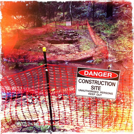
It was a miserable wet and cold mid-winter’s morning when Karen and I dragged ourselves out of the warmth of a Daylesford Cafe and started out along the Tipperary Track. For the first kilometre or so we debated as to whether this was such a good idea. Maybe we are getting soft but the thought of another round of tea and toast was almost too much to resist. Eventually the drizzle moved off elsewhere (probably to Trentham!) and small daubs of watery blue sky appeared between the low cloud. We had decided to brave the elements to GPS the Tipperary Track for our next Goldfields walking guidebook. I was also keen on updating some of the details, which have recently changed.

Wombat Creek Foot-bridge
Wombat Creek Foot-bridge still waiting to be built.

Since the floods in early 2011 some sections of the Tipperary Track have been closed. Almost all of the bridges had been damaged or washed away, which prevented walkers using the western side of Sailors Creek and therefore reducing any loop-walk opportunities. This has been a real shame as it’s one of the best and most popular walking areas within the Goldfields region. Recently Parks Victoria reopened The Blowhole area so that walkers can access the full length of the trail, which is also part of the now very popular Goldfields Track. Three foot-bridges are still to be either finished or built. The two foot-bridges spanning Wombat Creek and Sailors Creek at Twin Bridges have concrete foundations but still no steelwork. The third bridge is located at Tipperary Springs and although closed it looked very close to finished. Probably the most solid and flood-proof of all of the bridges is the massive new stepping stones across to Bryces Flat. To me this appears to be the best and cheapest way to build bridges, especially in country that regularly sees alternating periods of drought and flood.

The Blowhole
The Blowhole. The Tipperary Track, Daylesford. Hepburn Regional Park.

According to Parks Victoria the foot-bridges will be ready by this spring. Let’s hope so. If you are intending to walk the Tipperary Track right now though, you should be aware that without the bridge over Wombat Creek you will need to continue walking down the water-race on its southern side to cross the Midland Highway before entering the picnic area at Twin Bridges. It’s not a real hassle but just watch out for the traffic when you cross the bridge.

We arrived at The Blowhole just as the day was warming up (it must have been all of 8 degrees) and were now enjoying ourselves. The Blowhole was gushing with water and made for a fairly impressive sight. We continued on through Breakneck Gorge, which for me is the best part of the walk. The creek tumbled over it’s stony bed and the gorge’s narrow walls glistened with green moss. Every now and then a ray of sunshine penetrated the cloud and slid over a tree or a rock.

Isn't it about time Parks Victoria dragged this wreck from Breakneck Gorge?
Isn’t it about time Parks Victoria dragged this wreck from Breakneck Gorge?

Finally we left Sailors Creek behind and walked up along Spring Creek, again following a wide water-race overlooking the willow-infested creek. Somewhere down there was Liberty Spring, now no longer maintained. Not far along we reached Golden Spring, which is unfortunately still capped, although there are plans to repair it it some point. By the time we reached Jacksons Lookout it was getting late in the day. The steel and timber tower was very rundown and because of the surrounding trees there are no real views to enjoy. Jacksons Tower was something of a disappointing climax. Half an hour later and we were at Hepburn Springs Reserve. We had covered almost 17km in just over 4 hours. The cafe was shut and it was almost dark. A quick phone call and the taxi arrived a few minutes later. Soon we were back at the car at Daylesford Lake. We pulled out of the carpark just as it started to rain again.

Posted on 5 Comments

Hunting in our Parks: a Deal with the Devil?

Coming to a national park near you?

On June 20, 2012, the Feral Animal Control Amendment Bill is to be debated in the NSW Legislative Assembly. This Bill proposes to allow hunters largely unrestricted access to many of the best NSW national parks and reserves. A list of the proposed parks can be found here. If this Bill eventually passes it will directly effect how we as a nation are seen to manage and care for the future of our most precious natural landforms. But first, it’s worth looking at why NSW is considering such a backward step.

Despite what appeared to be a pre-election pledge to keep the state’s electricity assets in public hands, NSW Premier, Barry O’Farrell, announced in late November that his government was to sell off the state’s electricity generators. His comments that the state would retain ownership of the ‘poles and wires’ infrastructure couldn’t hide the fact that this was a major policy back-flip. The vast majority of the NSW public don’t want their electricity generators to be privatised, and who can blame them. There is plenty of evidence around the world that electricity privatisation almost always results in higher prices for the consumer and higher dividends for major shareholders (such as banks and pension funds). Here in Australia this has certainly been the case for both Victoria and South Australia where electricity prices have skyrocketed since privatisation, yet institutions have grown fat on the profits. There is also evidence that privatised electricity companies deliberately hinder the uptake of alternative green energy, which they see as potentially eroding future profit margins.

Unfortunately for Barry O’Farrell there was a fly in his ointment. The electricity privatisation bill had sailed through the NSW lower house in March but now sat gathering dust in the upper house. This is because the NSW Liberal/Nationals don’t have the numbers to pass it into legislation under their own steam. But all was not lost. The NSW Shooters and Fishers Party are represented in the NSW upper house by Robert Brown and Robert Borsak and it’s no secret that they want hunting access to NSW national parks. Of course the vast majority of park users are against the prospect of wholesale hunting in parks if only from a safety point of view. But the Shooters and Fishers Party quickly recognised this as a once in a lifetime opportunity. And so it was that the NSW Government and the Shooters and Fishers Party started negotiations. The fact that the NSW Government had already pledged that there would be no hunting in National Parks was not going to get in the way of the electricity privatisation Bill.

Just for the record, this is is an exchange made in the NSW Legislative Assembly in August of 2011 between Ryan Park, Labor member for Keira and Robyn Parker (NSW Minister for Environment).

Mr RYAN PARK: My question is directed to the Minister for the Environment. ….. what assurances can the Minister give that hunting in national parks will not be reconsidered in return for the support of the Shooters and Fishers Party for her Government’s legislative agenda?

Ms ROBYN PARKER: How predictable. The policy of the New South Wales Government is clear: hunting in national parks is not permitted. I say that very slowly for the slow learner on the Opposition backbench. Parks receive over 35 million visits per year and we provide among other things facilities for visitors to our State, and I advise the member opposite that shooting is not compatible with visitations to our national parks. The member has wasted yet another question. For the benefit of those opposite I repeat that the policy of the New South Wales Government is clear: Hunting in national parks is not and will not be permitted.

Source: Hansard Transcript

But as we know, when it comes to politics truth is the first casualty. Barry O’Farrell needed a deal and if that meant going back on his assurances that there would be no hunting in national parks then so be it.

On May 30 the NSW Government suddenly announced that changes to the Game and Feral Animal Control Act would allow for hunting within 34 National Parks, 31 Nature Reserves and 14 State Conservation Areas. Apparently this equates to roughly 40% of the land area controlled by NSW National Parks and Wildlife. It was a victory for the state’s hunters and a shock to the vast majority of park users who had believed the government’s assurances that this would never happen. Then in late May the Shooters and Fishers Party introduced the Feral Animal Control Bill 2012. This bill proposes to:

  • Allow the minister to make National Parks available “for the hunting of game animals by persons who hold a game hunting license“.
  • Allow for “expanding the list of game animals” that can be hunted on public land.
  • Prevent anti-hunting protesting by making in an offence “to interfere with a person who is lawfully hunting game animals on public hunting land” (including national parks).

Having served as a member of the Victorian Government’s Alpine Advisory Committee during 2010-11 and as a long-time bushwalker, rockclimber and cross-country skier, I well understand the problems we face with feral animals in our parks and reserves. Hell, I even recognise the need for some parks and reserves to be closed for short periods during which strictly managed feral culling can occur (such as what happens periodically in the Gammon Ranges in South Australia). However, I also believe that feral animal control first requires monitoring, evaluation and research. To allow hunters into a national park without scientific scrutiny is not the way to address the feral animal problem. I also don’t believe that hunters are doing this simply because they are suddenly concerned about the environment. In truth they simply want to hunt and there are plenty of hunters out there who are not particularly concerned about what they shoot. And do we really want to have hunters wandering around with high-powered rifles in parks where we are meant to be enjoying ourselves with our families?

As Tim Vollmer (The Fat Canyoners) so eloquently phrased it on his controversial blog, “To put it bluntly, feral animals are a serious issue, but one best addressed by professionals relying on science, not red-necks relying on firepower”.

Should this Bill be passed I can’t help fearing that it may just be the tip of the iceberg and that other states (under pressure of the politically connected shooting lobby) may eventually open up their national parks to hunting. This is something that should concern us all.

Please visit the National Parks Association of NSW for further details.