I finally ticked the Major Mitchell Plateau walk this weekend. I’ve been meaning to do the trail for some time but we have had a pretty wet and cold winter here in Victoria, which kept me away from the Grampians. Karen was still suffering from a virus she caught earlier in the week and decided she would act as my pickup from Jimmy Creek Campground. This well-known walk traverses the wild sub-alpine plateau linking the two highest summits in the Grampians National Park. Both Mt William and Durd-Durd share the same elevation of 1167m and are subject to the harshest weather and highest rainfalls in Western Victoria. Much of the trail is above 1000m and region bares a striking similarity to the landscapes of central and southwest Tasmania. I didn’t start the walk until midday which, as it was the first day of daylight saving, wasn’t as bad as it seemed. It was still too late for a demanding 19.2km walk however, and I really had to move quickly if I wasn’t to resort to using my headtorch.
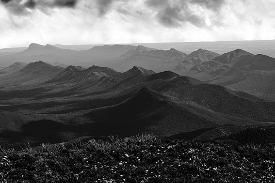
Firstly I have to say how much I hate the top of Mt William. The transmission towers really ruin what would otherwise be an amazing summit. I wonder how many other world-class national parks would allow transmission towers to be built on top of their highest peaks. It was as great to leave the towers behind and finally head out along the trail. I got to Boundary Gap in about an hour and started the real climb up onto the plateau. The path surmounts a series of small sandstone steps, which require a bit of easy scrambling. No big deal. Up on top the walking became much easier and I soon arrived at the First Wannon Hiker Campsite. The trail continued its gradual climb up along the edge of the expansive Major Mitchell Plateau crossing numerous little creeks and peat bogs. The plateau offers a semi-alpine landscape which is very exposed to the weather, especially to those cold southwesterly winds. This would be a very bleak place during the winter months. I finally got to the summit of Durd-Durd, which at 1167m is equal in height to Mt William. The contrast could not be greater, with no tourists and no transmission towers. The views are also outstanding, especially to the south along the jagged backbones of the Mt William and Serra Ranges. This is truly the roof of the Grampians. Unlike Mt William, this is a wonderful place to sit down and soak up your surroundings. The trail now dropped down the exposed hillsides overlooking the Wannon Valley before regaining the ridge leading over Banksia Hill. The descent now became much steeper and my knees were very glad to reach the grassy openings of Stockyard Saddle. From here the trail descended much more gently down a long ridge then through open forest. I arrived at Jimmy Creek Campground at 6pm having taken six hours from the start of the walk. To be honest I wouldn’t recommend doing this walk in anything less than seven hours as it really deserves to be savoured. Definitely one of the best daywalks in the Grampians.


I feel obliged to comment on the Mt william tower comment… Whilst building towers in NP’s may not be ideal, the towers here came first and the National park second. Regards, Peter
You are right Peter. The transmission towers were built before the National Park. I definately could have worded it better. It’s certainly not Parks Victoria’s fault that what should have been one of the state’s most attractive mountains is today nothing but an eyesore.