Posted on Leave a comment

Problems With Falcons Lookout Walk and Ironbark Gorge Carpark

There are four official public entrances into Werribee Gorge State Park. The main entrance is via Myers Road on the eastern side of the park and is accessed via the Western Freeway from just past Bacchus Marsh. The other three entrances are located along Ironbark Road via Western Bluff, Ironbark Gorge and Ingliston Gorge Carparks. Western Bluff Carpark provides access to Western Bluff Lookout and is occasionally used by walkers descending the spectacular Needles Spur (through private property) into the gorge. Ingliston Gorge Carpark provides access to the Ingliston Block, the isolated western arm of the park, while Ironbark Gorge Carpark provides access to the Falcons Lookout Walk, the Ingliston Granites and Ironbark Gorge. Ironbark Gorge Carpark is also the nearest trail-head for Falcons Spur, an increasingly popular walk that descends into the gorge (again through private property). Falcons Lookout itself is one of the most popular rockclimbing destinations close to Melbourne.

Over the past year I’ve noticed that Ironbark Gorge Carpark has become increasingly busy. In fact it’s not uncommon to find 6 to 8 cars and perhaps a bus using the carpark on any midweek day. On the weekend I have seen up to 50 or more climbers at the cliff and perhaps a dozen or more walkers on the trails. This equates to at least a dozen or more vehicles crammed into the tiny carpark. I don’t know the actual park user numbers but I suspect that on many days there would be more visitors accessing the park through the ‘back-door’ of Ironbark Gorge Carpark then would be along the ‘official’ Myers Road entrance.

Interestingly, Myers Road is serviced by two large carparks (the Quarry Picnic Area and Meikles Point Picnic Area) and each have have picnic facilities, BBQs and toilets. In comparison, Ironbark Gorge Carpark is very small and rough to say the least. The geography of the area means that this carpark can’t be made much larger, but it could benefit from a redesign if it is to cater for the growing numbers of cars using it. The carpark also has no toilets. While this would be a minor issue for some, it is a major issue for many. Both walkers and climbers are forced to go bush and this is simply unacceptable at such a heavily used carpark as this. Perhaps having a toilet in the carpark would help to reduce the enormous number of poos and loo paper scattered around the vicinity of Falcons Lookout. In fact, the situation is becoming so bad at Falcons Lookout that perhaps the best thing to do would be to build a drop toilet on the adjoining saddle.

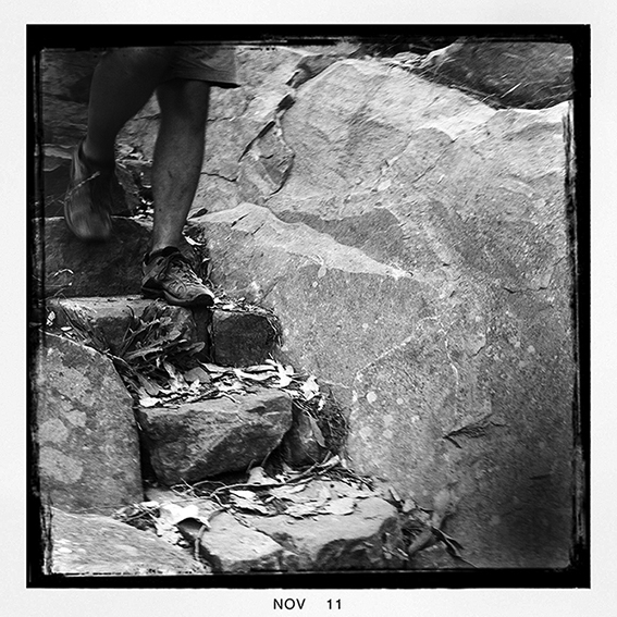
Which brings me to my final gripe. The initial section of trail (down past the old railway workers hut sites) into Ironbark Gorge is a complete disaster. The contractors that Parks Victoria used to ‘fix’ this section of the trail have done an awful job. If anything, the pine boards anchored across the trail has worsened the erosion and created a major eyesore. Simply put, this section of the trail is loose, ugly and dangerous. With the large numbers of people using the Falcons Lookout Walk you would have expected Parks Victoria to have properly fixed this trail a long time ago. Possibly the only way to save this trail now would be for Parks Victoria to contract a reputable construction company such as TTMS (Track and Trail Management Services) to rebuild it. Failing that (and knowing how little money Parks Victoria these days invest in high-quality long-term trail maintenance) it may be simpler, cheaper and quicker to realign this section of the trail down the spur 20m or so to the west, then cut it back to the point at where the original trail reaches the bottom of the initial gully. This would greatly reduce erosion problems and is where the trail should have gone in the first place.


Posted on 13 Comments

Melbourne’s Western Gorges On Sale Now

Great news. Our newest title, Melbourne’s Western Gorges, arrived in our warehouse this morning and will be in the shops from tomorrow. Authored by Glenn Tempest, this is the first in a new A5 series of walking guides to regional areas around Victoria. Melbourne’s Western Gorges covers 20 walks in the Brisbane Ranges National Park, and Werribee Gorge and Lerderderg State Parks. Produced in full colour with 96 pages it retails for just 19.95. Like our last book, Daywalks Around Victoria, this guide also features free GPS downloads as well as regular updates. Melbourne’s Western Gorges is also available in our online bookshop.


Posted on 4 Comments

Jawbone Track Repairs Finished

Last week Greg and I walked up to the top of the North and South Jawbone Peaks in the Cathedral Range State Park. I was really keen to check out the new trail work on the Jawbone Track leading up to the Farmyard. The 2009 Black Saturday bushfires really hammered this part of the range and, while this trail has always suffered from erosion issues, the fires made things a whole lot worse.

The initial walk up from the Jawbone Carpark is nicely contoured and Parks Victoria have replaced the original bridge over MacLennans Gully with a new steel construction. Hopefully this bridge will withstand future low and medium intensity fires. Personally I can’t see the need for expensive bridges spanning minor water courses that for 98% of the year can be easily stepped over, although I’m sure most walkers will welcome the convenience.

The trail up to the first rocks was realigned quite a few years back and it is still in excellent condition. From the rocks the trail cuts across to Jawbone Creek, crosses it and then climbs steeply up to The Farmyard. This section and the trail has always suffered from bad erosion and the 2009 Black Saturday bushfires made things a whole lot worse. If you’ve hiked up to the Jawbone Peaks since the park was reopened after the fires you will know that work on this trail has been progressing for sometime. As it is Parks Victoria and their contractors have done an excellent job. The careful placement and seating of large blocks (and all without the use of cement) means that the trail will be far more resilient to heavy foot traffic and now blends in really well with the natural surroundings. Two thumbs up for a job well done.

From The Farmyard we continued up to the top of South Jawbone Peak. Essentially the trail to the summit is okay but is now so overgrown as to be difficult to follow. In fact I would say that the regrowth is far thicker now than it was before the 2009 fires. What a difference a couple of years makes! While the hazel pomaderris is especially thick, it is the kangaroo wattle (or prickly wattle, acacia paradoxa) that is making life difficult for walkers.

Most likely much of this regrowth will die off over the next few years as the forest re-establishes itself, but in the meantime it’s a real pain. Maybe Parks Victoria should send in a crew to re-cut the trail although I’m not sure exactly how long this would last. Luckily the trail up to North Jawbone Peak is much better, but there are still short sections of thick regrowth and the kangaroo wattle is growing strongly on the upper rocks near the summit.


Posted on Leave a comment

Camels Hump: Digging in the Dirt

Three new bolts (with quick-draws) on Lola V. Michael stepping right into Bloodline.

Each of the three routes described below have been worked on in consultation with other local climbers and with the first ascentionists. These three climbs were all suffering from major issues and were either unclimbable, badly bolted and/or dangerous.

Sluts Honour has had a slightly different start added (one bolt) by coming in from the left (low down on Grey Arete). A bolt was added above the ring-bolt to better protect the crux moves (now avoiding the potential ground-fall). The top ring-bolt was originally placed too far to the right and was a major pain to clip so I added another bolt 1m horizontally to its left. I left the ring-bolt in place as it’s still convenient to protect the moves on the link-up The Sluts Alliance. Sluts Honour now climbs really well, has three 90mm x 12mm expansion bolts, a single glue-in and a more enjoyable start. The grade is probably now more like 22 (rather than its original 23). Some people will still want to place a medium cam at the stance, but most won’t bother.

Underseige had a large flake break off the crux maybe 15 years ago and the route subsequently vanished into a thick carpet of moss. The climb has now had a massive brushing and I placed glue-in lower-off anchors on top. I also removed the (original) bottom expansion bolt as it was in poor condition and refused to tighten. The top (original) expansion bolt appeared good but I replaced the hanger. I also added a much more logical direct start from the ground to avoid stepping in off the ledge. Underseige now has three glue-in ring-bolts and a single expansion bolt. Some people will still want to place a medium cam at mid height, but most won’t bother. Underseige is still about grade 23.

Lola V (on the Omega Block) was put up in the early 1980s with just the one mild-steel carrot bolt. Over the years it has had very few repeats since the bolt is rusted and there was a distinct possibility of decking off the hard moves getting to it (not to mention the massive run-out after clipping the bolt). After a brushing I added three 90mm x 12mm expansion bolts. The original carrot is still there but I’m hoping to remove it soon. After the third bolt the route is best climbed by stepping right and finishing up Bloodline to its lower-off anchors. You’ll need five draws in total (plus two more for the lower-off). Lola V is now grade 22, has nicer and better-protected climbing than Bloodline and will probably be a whole lot more popular.

Posted on Leave a comment

Jetboil Sol Ti Stove Review

Cooking with gas. Jetboil Sol Ti.

For the last six years or so I’ve been using the Jetboil cooking system and I have to say it has performed flawlessly (except for the piezoelectric push-button igniter, which has never really worked for me). Lately though I’ve been shaving the weight I carry and when I heard about the Jetboil Sol Ti I decided to upgrade. First issue was that it wasn’t available for sale in Australia. I always try to buy local (even if it works our a few dollars more), mainly for peace of mind when it comes to warranties. In this case it simply wasn’t available and even as I write this review (three months after purchasing it) I’m still amazed that I can’t find it for sale in Australia. I ended up buying mine from the REI store in Fresno, California, for about $120. The Aussie dollar was pretty strong at the time and I considered this a bargain.

So how does the Sol Ti differ to the original Jetboil. Well for starters the Sol Ti’s cup is made of titanium. The original weighed 200g and the new Ti weighs in at 115g. A substantial saving but you have to take into consideration that the Sol Ti cup is also a tad smaller (by about 200ml). I didn’t find this a big deal and ended up preferring the smaller size. The Sol Ti also comes with a thinner (some might say ‘flimsier’) neoprene cozy. There has been some criticism about this cozy but I found it worked really well in the field and I never felt the heat through it as some people claim. As for the piezoelectric push-button igniter, well lets just say it has its good and bad days. I simply don’t use it any more and wish that Jetboil would just get rid of this ‘feature’ and save a few extra grams. The stove unit itself is also lighter and has what I think a more refined heat control and a better wire flame control handle. Definitely easier to use.

In a practical sense the Jetboil was designed to mainly boil water or other liquid foods (such as soup). It was never designed to cook thick stodgy meals (such as risotto) as the heat control doesn’t allow for effective simmering. The pot is also completely the wrong shape, although the addition of a pot support means that you can buy the larger group-sized cooking pot. For me the Jetboil works great since I almost entirely use the Jetboil to boil water to reconstitute pre-cooked dried meals. Overall the Sol Ti is fast and more importantly it’s reliable.

Original Jetboil weight (cup, lid, cozy, pot support and stove unit): 495g

Jetboil Sol Ti (cup, lid, cozy, pot support and stove unit): 340g

The difference in price between the Original Jetboil (or the current Jetboil Sol Advanced) and the Jetboil Sol Ti is about $30 – $40. That translates as about $10 for ever 40g in weight saved. Pretty expensive when you think about it but shaving those vital grams comes at a premium. All up the Jetboil Sol Ti gets a two-thumbs-up from me.

Visit Jetboil

• Jetboil Thermo-Regulate™ technology – consistent heat down to -6?C
• 0.8 Liter Titanium FluxRing® cup
• Insulating Cozy
• Convenient, reliable push-button igniter
• Pot support and Stabiliser tripod included
• Drink-through lid with pour spout & strainer
• Bottom cover doubles as a bowl and measuring cup
• Compatible with all Jetboil accessories


Posted on 4 Comments

Mt Alexander Regional Park: Walking Trails Falling Into Disrepair

I was up at Mt Alexander Regional Park on Sunday checking out the main walking trail loop for our forthcoming guidebook, The Goldfields. I’ve done the Mt Alexander walk at least four times, the last time in 2005 for our Daywalks Around Melbourne guide. What really struck me on Saturday was just how run-down the walking trail infrastructure has become. Following our map in Daywalks Around Melbourne, we walked the Goldfields Track from McQuillans Road to Ballantinia Track via Dog Rocks and Langs Lookout. This walk has been  realigned up through the old Koala Park and now has the distinctive Goldfields Track ‘gold-tops’, walking trail marker posts painted yellow. The grass is currently very high and in places the trail is barely visible and the gold-tops really help.


Despite this the trail along this section of the walk is what I would classify as in average to poor condition. Signage could have been much better (no sign at the junction leading to Leanganook Picnic Area is especially confusing) and the trail is in need of urgent maintenance and erosion repair, particularly under Scorpion Rocks (the boulders midway between Dog Rocks and Langs Lookout). The trail leading up to Shepherds Flat Lookout is currently impossible to locate and the signage is either non existent or falling to bits. The walk up along Ballantinia Track was enjoyable and much better than I remembered it, most likely due to the fact that no vehicles have used it, probably since the January 2011 floods.

Perhaps the biggest disappointment of the day was the southern section of the West Ridge Walking Track which is links Dog Rocks carpark to a small carpark just west of Leanganook Picnic Area. This trail is marked by Parks Victoria on the Mt Alexander Regional Park Park Notes. Parks Victoria also have info boards in the park showing this walk in detail. Interestingly there is no signpost indicating the start of this walk in the Dog Rocks carpark and we could only find a single very old marker post 200m into the forest. After a long search in the undergrowth we finally gave up looking for this trail. It seems to have been reclaimed by the bush.

Mt Alexander Regional Park is a major recreational asset due to its close proximity to the growing regional centres of Bendigo and Castlemaine, and its now quick and easy access from Melbourne along the new Calder Freeway. Instead of developing and maintaining important walking trails to encourage people to use this beautiful reserve Parks Victoria it seems is just letting them slowly decay away. As I’ve said before, it’s all well and good to put in walking trails, but there must be a budget to make sure that these trails are regularly maintained. It’s such a shame that for one reason or another Parks Victoria don’t seem to be able to do this in Mt Alexander Regional Park.

Posted on 2 Comments

Food For Thought


One of the things that surprised me during our recent 24-day walk along California’s John Muir Trail was how popular the instant (dehydrated or freeze-dried) food pouches are in the United States. We saw a lot of people at various campsites along the way and I can’t think of seeing anyone cooking in a billy or lightweight frying pan. Even those out in the mountains for just a couple of days all seemed to be going down the dehydrated path. Considering how cheap these dehydrated foods are, and the fact that they taste pretty damn good, you can understand their popularity. Add to this the convenience of not having to carry a bowl or billy. You simply pour a cup or two of boiling water into the pouch, let it sit for five minutes and then eat. No more washing up. I like it.


Normally Karen and I dry our own meals. Unfortunately bringing our own dried food through US customs was not going to be straightforward. Buying the food pouches in Australia was also not an option as the variety is very limited and the prices the outdoor retailers charge here are well over double that in the United States. In the end Karen ordered the bulk of our main meals from a place called Mary Janes Farm, a sort of hippyish organic farm produce place in Moscow, Idaho. We also bought a bunch of Enertia breakfast and desert food pouches from Wilderness Dining. The guys at both Mary Janes Farm and Wilderness Dining were really helpful and organised to post our order directly to our hotel in Yosemite Valley. This worked out really well.

So how did it taste? Considering we usually dry our own foods (which are cooked exactly to how we like them) I was pleasantly surprised. Just about all of these commercial dehydrated meals were delicious. Perhaps the only minor point is that some of the Mary Janes Farm main meals were a tad bland, but we carried a bunch of small hot chilli packets which we used to fire them up a bit. The Mary Janes Farm products were organic (a good selling point to us) and the packaging had the added advantage of being burnable (a major consideration on long walks). Perhaps my only regret in having experienced these newer dehydrated pouch foods is that I’m now wishing we had these or similar brands available (at a reasonable price) here in Australia.


Posted on 2 Comments

John Muir Trail

I’ve finally uploaded some of my images from our recent walk across California’s John Muir Trail. The walk links Yosemite Valley and Mt Whitney and took us 24 days to complete. I’ve started captioning the images but it will be a few weeks before they are all completed.

A couple of chipmunks come out to play.


[smugmug url=”http://openspaces.smugmug.com/hack/feed.mg?Type=gallery&Data=18989698_ZjMNpc&format=rss200″ imagecount=”24″ start=”1″ num=”100″ thumbsize=”Th” link=”smugmug” captions=”true” sort=”true” window=”false” smugmug=”true” size=”M”]

Posted on Leave a comment

Meridian Maps & the Great South West Walk

Open Spaces sells a number of the highly regarded Meridian Maps so we thought it a good opportunity to share the news of their latest map release.
In their first map co-production Meridian Maps and Carto Graphics have produced a double sided 1:50,000 topographic scaled map that covers the Glenelg River from Dartmoor down to Nelson and the river mouth and the complete Great South West Walk circling from Portland to Nelson and back again.
This is actually the first map of the area which cover the internationally renowned Great South West Walk in such detail.. Covering 250 kms, the walk traverses many different landscapes from forest, riverine, coastal, farm and urban environments making it one of the worlds most diverse great walks. There are also approximately 20 short walks one can take to explore this spectacular, but often, forgotten part of Victoria.

There is also a new updated edition of the Lerderderg & Werribee Gorges map. Once again, this area of Victoria, so close to Melbourne is underutilised by walkers and visitors and the spectacular gorges will not disappoint. Most importantly this edition now contains the ESTA Markers as they now now appear in the park.  More recently Parks Victoria changed the markers without leaving any reference to the old emergency numbers.  This caused some confusion as all written reference was to the old markers.  With this new update this issue has now been resolved.

You can purchase both of the maps from our online bookshop.

Posted on 2 Comments

Arapiles iPhone App Released

It’s been a long time in the planning but it’s finally here. Arapiles Selected Climbs is now available as an app through Apple’s iPhone App Store. Open Spaces have been working with the guys at iCrag for almost a year to help create what we believe is the world’s best climbing guide app. Arapiles Selected Climbs combines text and images with innovative live navigating tools and is a big step forward in usability and design. For Open Spaces this app also marks an exciting new chapter in our publishing future.

App features include:                                                                                
Over 1100 selected routes
Over 150 cliff images
Text descriptions and first ascent details
Advanced search facilities
Zoom functions
Climb grade index
Climb name index

The app sells for $29.99. Those purchasing the app will be entitled to a 25% discount (from Open Spaces) on the print version of Arapiles Selected Climbs.

Compatible with iPhone, iPod touch, and iPad. Requires iOS 4.0 or later. File size is 228MB.

Visit iCrag or the App Store.