According to Parks Victoria: Closures due to upgrade of Painkalac Reservoir Spillway No access to Painkalac Reservoir until late 2010. Walking track from Distillery Creek Picnic Ground to Painkalac Reservoir closed until late 2010. Walking track leading from Moggs Creek Picnic Ground to Gentle Annie Track remains open. Walking track through reservoir from Distillery Creek… Continue reading Walk 4 (Painkalac Dam)
Category: Daywalks Around Melbourne
Walks 56, 57 (Masons Falls and Andrew Hill)
Masons Falls Walk. Mt Sugarloaf is now open to the public. This includes Mt Sugarloaf, Mt Sugarloaf Road, Mt Sugarloaf Ridge Track and the park entrance area. These areas open everyday from 9:00am until 4:00pm. The walking trail (Mason Falls Circuit) and the rest of the Sugarloaf Block are still closed. Masons Falls Picnic Area… Continue reading Walks 56, 57 (Masons Falls and Andrew Hill)
Walk 69, 70, 71, 72 & 72 (Cathedral Range)
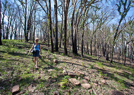
Yesterday I spent the day walking between The Jawbones and Cathedral Mountain. While the park was closed (due to the Black Saturday fires in 2009) Parks Victoria have done quite a bit of trail maintenance and realigning work. The trails around the Farmyard have been been realigned slightly but are clearly signposted. The trail linking… Continue reading Walk 69, 70, 71, 72 & 72 (Cathedral Range)
Walk 11 (Bells Beach and Ironbark Forest)
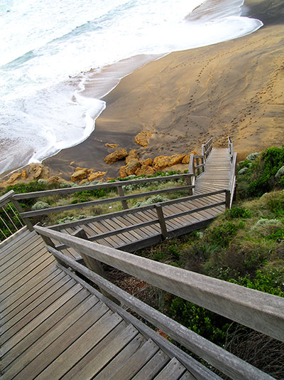
The day had started with us dragging our two tired bodies, one old, one young, into the car for the trip to Bells Beach from Melbourne. We had both been looking forward to the hike, but ironically, we were both drained from hearing a Tibetan Buddhist teacher talk late into the previous night. The drive… Continue reading Walk 11 (Bells Beach and Ironbark Forest)
Cathedral Range State Park (After The Fires)
Tracey and I paid a visit to the Cathedral Range State Park last Wednesday. Tracey was there in her official capacity as the Victorian Climbing Club (VCC) Access Officer and was checking out the climbing access trail up to North Jawbones – one of the most popular and important climbing crags in Victoria. I was… Continue reading Cathedral Range State Park (After The Fires)
Fire damage affecting information in several guidebooks
The terrible Victorian bushfires that started over the weekend of Sat 7th and Sun 8th February mean that some walks described in Daywalks Around Melbourne (Tempest), Weekend Walks Around Melbourne (Tempest) and Day Walks Melbourne (Chapman) have been completely destroyed. The main areas affected include Marysville, Kinglake, Murrindindi, Bunyip State Park, Healesville, Warburton and the… Continue reading Fire damage affecting information in several guidebooks
Lerderderg Gorge Emergency Markers
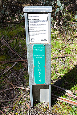
IMPORTANT UPDATE: All of the original EMERGENCY SIGNPOSTS in the gorge have been replaced with new EMERGENCY MARKERS by ESTA (Emergency Services and Telecommunications Authority). Of major concern, however, is that the original numbering has been changed. The old (original) numbering is still in use in a number of available publications, including two of our… Continue reading Lerderderg Gorge Emergency Markers
Walks 68 to 73 (Cathedral Range State Park)
Walks 68, 69, 70, 71, 72 and 73 (all within the Cathedral Range State Park). The park is closed. Roughly 92% of the Cathedral Range State Park (including the visitor facilities at Sugarloaf Saddle) were burnt by the February 2009 Black Saturday bushfires. Parks Victoria have indicated that the park will be reopened progressively from… Continue reading Walks 68 to 73 (Cathedral Range State Park)
Walk 67 (Cumberland Walk)
The southern section of the Cumberland Walk is closed. The northern section between Cambarville and the Cora Lynn – Big Tree Carpark is open and accessible from either site.
Walk 65 & 66 (Lake Mountain)
Walk 65 (Lake Mountain Snowgum Walk) and walk 66 (Lake Mountain Summit Walk) are open to walkers. There is lots of forest damage so I’d suggest that walkers keep to the trails to aid the regeneration process.


