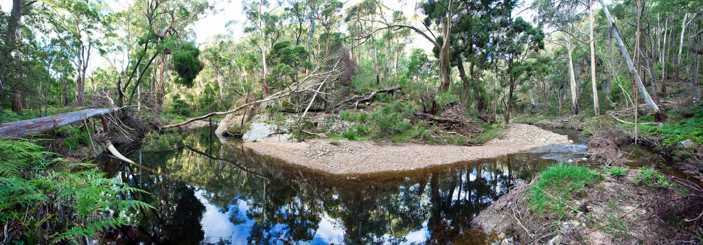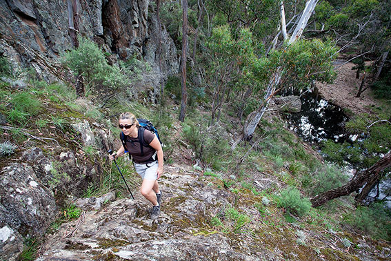
Karen and I completed a walk last weekend in Lerderderg State Park linking Short Cut Track, Trout Track and Clear Water Creek / Ambler Lane. We finished the walk along a short stretch of the Lerderderg River back to O’Briens Crossing. It was an excellent outing and will almost certainly be included in our forthcoming new walking guide to Melbourne’s Western Gorges (the Brisbane Ranges, Werribee and Lerderderg State Parks). What really amazed us was the amount of flood damage and debris along the river.
The section of trail I’m talking about runs along the Lerderderg River from the Tunnel to O’Briens Crossing. In the past this was definitely one of the most enjoyable short walks in the park as it had wonderful river views combined with rugged cliffs, stands of tall manna gum and plenty of gold history along the water race. Over the last 10 years this trail fell into major disrepair and parts of it were downright dangerous (particularly in wet weather). What I’m hoping is that Parks Victoria will now re-look at this trail (starting along Byers Back Track) and make it one of the key circuit walks in the park. It will take a bit of work and lots of flood debris will need to be cleared but there is no doubt that this trail could be the showcase walk in the Lerderderg State Park. Interpretation signs could also be installed. Right now the walk is closed and with good reason. You can’t even see the trail in places as it is buried under piles of timber. I just hope that Parks Victoria allocate the necessary funds and rebuild what could be one of the best trails near to Melbourne.


I walked from McKenzie’s Flat to the Long Point diversion dam last weekend, in the southern section of Lerderderg Gorge, and the flood damage was extensive. Last time I did this walk it took three hours to do that leg (which is the time listed in the book). Last weekend it took five hours, due to flood damage, the river being fairly high (making rock hopping tricky) and the amount of growth that’s happened. There used to be discernable tracks in some places but not anymore. Not to mention the large number of huge spiderwebs that we chose to walk around, not through!
John.
Can you please let me know when I can purchase the book on the Western Gorges?
I have walked most of the walks in your Daywalks book, many of the Weekend walks, and now look forward to the Daywalks around Victoria. I live in Bacchus Marsh and would dearly love more walking guides out this way. I love the way you have allowed people to get the GPS data for these walks. I recently bought a Garmin 450T and have just installed the Clearwater walk to do this weekend. I hope that it is a reasonable condition
Hi Suresh. Glad you are enjoying the guides. We are working on both the Western Gorges and Goldfields guides right now. The Western Gorges guide covers the Brisbane Ranges National Park, Werribee and Lerderderg State Parks and will be available this spring. Our books will be more region specific from now on. Clear Water Creek is an excellent (mainly off-trail) walk but definitely avoid it in the wet. Those rocks in Lerderderg can get very slippery. Sunday looks to be perfect late autumn weather. Have fun.
John. You are spot on with the flood debris issues in the gorge. Pretty much all of the walks that wander along the riverbed or banks will take longer than the times we give in our guides. I chatted with Parks Victoria the other day and they are in the process of doing some clearing on official trails (but not along the off-trail walks of course). Also, because of the recent rainfalls there is a lot of regrowth. The spiderwebs have been amazing this year. You can bounce off those orb webs! I suspect that all that rain brought out more insects and the spiders have been taking advantage of it.
I bought Daywalks Around Melbourne to try and help decide where to take a first time visitor from Boston, for a few days in late June. I can’t decide between the Otways – ocean/apostles and Lerderderg – wildlife/rugged beauty. My research suggests both areas can be damaged in heavy rain, I’m interested in doing a few 3-5 hour moderate walks. Can any one give me an educated opinion about where is the best destination to give my friend an awe-inspiring hiking experience?
Thank you!
Hi Gillian. Due to the adverse weather of late some walks in the Great Otways National Park are closed. Garvey Track due to wet conditions. Sheoak track (Sheoak picnic ground to Swallow Caves).
Currawong Falls walking track, due to bridge works. Kalimna Falls walking track and Link track. Gentle Annie Track and Moggs Creek Track. The walking trails are also getting pretty boggy as winter takes hold. Lerderderg Gorge is suffering also. Walks along the river have problems with flood debris. I would personally think about The Scenic Rim (walk 31) in Lerderderg which is in good condition (you may get your feet wet crossing the river below the dam wall) and is really close to Melbourne. Also Mt Alexander (walk 48) will be getting greener and you could stay in Bendigo for the full gold-rush experience. Also close to Melbourne is Werribee Gorge. Visitors always find this place impressive and can’t believe how close to the city it is. The classic walk is the Werribee Gorge Circuit (walk 26). If you want a longer walk (with even more amazing scenery) you can combine Western Bluff and Ironbark Gorge walk with the Werribee Gorge Circuit. Start from Western Bluff Carpark. Instead of finishing up Ironbark Gorge to get back to the carpark (as per the description) there is a walking trail leading from the mouth of the gorge directly up a long ridge to Falcons Lookout (the best view of the gorge). This walk is covered in our new Daywalks Around Victoria. We also have a GPS download (on our downloads page) so you can check it out on Google Earth or install it into your hand-held GPS device. Hope this helps.
Hi Glenn
I’m planning on taking my hiking group to do The Scenic Rim this Sunday. Is there any updates you can give on the status of the trail?
Thanks!
Hi Peter. Right now this walk is in fairly good condition. There is quite a bit of flood debris along the initial section of the gorge but most of it is easy to avoid. After this recent rain I would say that you may get your feet wet at Grahams Dam. I’m not sure how much water (if any) is backed up at the Lerderderg Weir (this is where the diversion tunnel carries water through to Merrimu Reservoir) so you will have to judge it when you get there. It’s usually pretty straightforward getting to the far side. Just be careful of the initial scramble up from the wall to gain Long Point Track (its a bit of a loose scramble). There is actually a bit of a rough pad starting left of the wall which avoids this scramble. I was in the middle reaches of the gorge last weekend and there is a good flow in the river right now. Have a great walk and I hope the weather is good for you.
Hi Glenn. Three of us completed The Scenic Rim on Sunday. We did get a little wet feet with the river crossings. The main issue we experienced was at the weir. The water was indeed backed up along the far-side and therefore the stairs decented into water – we had to swing down to the lower staircase at the bend. This hike is amazing and rewarding. Thanks for the updates.
Hey Peter. I agree with you that this is a great walk. Also really interesting to hear about the weir conditions right now. Plenty of water coming down thats for sure. And we haven’t reached spring yet! BTW, we have a new book coming out at the start of November called Western Gorges which will focus on the best walks in the Brisbane Ranges, Werribee and Lerderderg Gorges. Stay in touch.
Hi Glenn,
Loving the Western Gorges guide. We warmed up with a day hike around Werribee Gorge a few weeks back and then decided to head to Lerdederg for a quick overnighter over the previous weekend.
We decide the rim walk was about the right distance and difficulty. The day began with constant but light rain and thick low cloud cover. We headed off up to Graham’s Dam and then decided to go clockwise around the rim, with the idea to get the longer and harder sections out of the way on day one. We headed up Link Track #1 (hard), along Blackwood Ranges tack (blissfully easy), then a difficult descent down Longpoint Track to the weir. I found this the hardest part of the hike, and was pretty shakey kneed at the bottom! There were parts where we decided it was safer to remove our packs and lower them down as it was quite slippery in parts. We were all very happy to reach the bottom! All in all, including breaks, it took us 5.5 hours to make camp.
We camped at a nice flat and open area adjacent to the weir, plenty of firewood, and easy access to fresh water. The clouds cleared, the stars shone and a relaxed night around the campfire was had by all.
Next morning we packed up early and headed up the weir access track (a nice easy warm-up for tired muscles) until we got to the Spur Track and head down again. My quads started screaming at this point! It was turning into a glorious day and though the descent was difficult in parts due to the shifting rocks underfoot we enjoyed some fantastic views that were obscured by the previous days weather. Interestingly I found a house brick on the trail about halfway down. How the hell did that get there? Passed a few hikers on the way up, then many more on the Lerdederg Gorge Walk track at the bottom. The gorgeous weather (no pun intended) had brought many people out, which was nice to see.
We made the back to the McKenzie Flat car park in just under 3 hours, leaving us plenty of time to head into Bacchus Marsh for a counter meal at the pub.
I certainly found the spur descents challenging, even a bit hairy in parts, but all in all we agreed it was a great hike. We will be returning soon, but I think I had better work on my fitness!
Cheers,
Steve
Hi Steve,
Really glad you loved the hike. It is still one of my favorite walks as it provides some great views of the gorge. I especially enjoy the section along Long Point Track but I must confess that I’ve never descended it. I suspect it would be much easier to ascend it as scrambling is always easier when going up!
Cheers,
Glenn
Hi Glenn,
We hiked today from Obrian’s Crossing hoping to complete the circuit “Tunnel walk”. To our surprise the Tunnel walk is no longer a circuit walk and is only a return walk, never the less, we still enjoyed the hike.
Can you please advised have you revised “Daywalks” around Melbourne? I still have the first edition and am considering an updated version.
cheers
Joseph