Thought I’d post this short echidna video. This was Karen’s first ever video using her tiny Canon Ixus 65 camera during a day walk at Cradle Mountain in Tasmania. She was so new to the camera that she didn’t even know how to turn it off at the end! The result isn’t too bad though… Continue reading Curious Echidna
Tag: bushwalking
Mt Kooyoora

One of the 36 walks we are featuring in our soon to be released Daywalks Around Victoria will be a traverse across the summit ridge of Mt Kooyoora, the most northerly mountain in the central Victorian goldfields area. Mt Kooyoora State Park is a real gem and is located 220km northwest of Melbourne, about 35min… Continue reading Mt Kooyoora
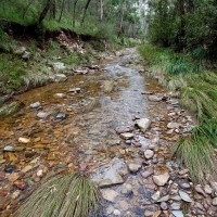
Lerderderg Gorge Flood Damage
Karen and I completed a walk last weekend in Lerderderg State Park linking Short Cut Track, Trout Track and Clear Water Creek / Ambler Lane. We finished the walk along a short stretch of the Lerderderg River back to O’Briens Crossing. It was an excellent outing and will almost certainly be included in our forthcoming… Continue reading Lerderderg Gorge Flood Damage
Marysville Trails 2011
Following the Black Saturday bushfires in 2009 pretty much all of the walking trail infrastructure in and around Marysville had been wiped out. I was in no doubt that repairs, rebuilding and realignments of this trail network would be at least a few years away. These fires meant that users of our Daywalks Around… Continue reading Marysville Trails 2011
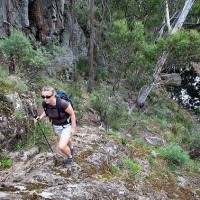
A low point in the High Country
In the mid 1970s, when I was about 18 or so, I spent the summer with friends rockclimbing at Mt Buffalo. While I was there I met a park ranger from the United States. He was on some sort of exchange program for what was then called the National Parks Service. In the mornings he… Continue reading A low point in the High Country
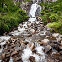
Grampians Flood update
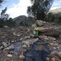
Following the recent heavy rains and ensuing floods, many of the parks in Victoria have closures in place. Either full closures like the You Yangs or partial closures such as the Grampians. In regards to the Grampians, a huge amount of the park took a beating – with landslides and road collapse hitting the top… Continue reading Grampians Flood update
The Overland Track (Tas)
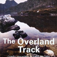
Every now and then a new title comes out that really impresses me. The new walking guide, The Overland Track, by Warwick Sprawson is one of those guides. The cover indicates that this is a ‘complete guide to walking, flora, fauna and history’ and it doesn’t disappoint. The book comes in a very handy pocket-size… Continue reading The Overland Track (Tas)
The Pyrete Range (Lerderderg Gorge)
In recent months I’ve been spending quite a bit of time exploring the Pyrete Range, an isolated block of mountainous bushland on the eastern side of the Gisborne to Bacchus Marsh Road and a fairly recent addition to the Lerderderg State Park. Despite its nearness to the western suburbs of Melbourne (less than 15km) this… Continue reading The Pyrete Range (Lerderderg Gorge)
Argentina and Chile 2006
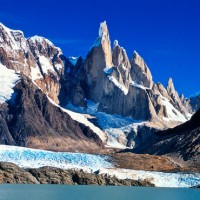
A selection of pics from my trip to Patagonia [smugmug url=”http://openspaces.smugmug.com/hack/feed.mg?Type=gallery&Data=14277765_6UZZv&format=rss200″ title=”Argentina%20and%20Chile%202006″ imagecount=”100″ start=”1″ num=”100″ thumbsize=”Th” link=”smugmug” captions=”true” sort=”true” window=”false” smugmug=”false” size=”M”]
Walk 80 (Dandenong Ranges)
Walk 80 (Olinda Falls) The northern half of VW Track has been permanently closed which means that this walk cannot be completed as described. See p.193 and use this map to continue walking down Olinda Creek Road to return via Bartlett and Barges Track. This will add at least 2km to the total distance as… Continue reading Walk 80 (Dandenong Ranges)